Ngetypneveyem ( Netpnevayem ) - a river in the Far East of Russia . It flows through the territory of the Chaunsky district of the Chukotka Autonomous Okrug . The length of the river is 63 km [2] .
| Ngatypnevayem | |
|---|---|
| chuck. Ӈhelpyӈaveiem | |
| Characteristic | |
| Length | 63 km |
| Watercourse | |
| Source | |
| • Location | Rauchuan Range |
| • Coordinates | |
| Mouth | Linline |
| • Location | Chaun Lowland |
| • Height | 61 m |
| • Coordinates | |
| Location | |
| Water system | Linlineinem → Olvegyrgyvaam → Leluyem → East Siberian Sea |
| A country |
|
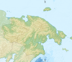
| Region | Chukotka Autonomous Okrug |
| Area | Chaunsky district |
| HWR code | |
It is named for the nearby mountain, translated from Chukot. Ӈelpyӈeyveem - “a river by a mountain similar to a trigger of a gun” [3] .
It takes its sources from the northern slopes of the Ostrayaya Sopka mountain, flows northeastward along the territory of the Chaun Lowland , and flows into Linlinewey on the left. The height of the mouth is 61 [4] m above sea level.
Tributaries: Maison, sedge.
Notes
- ↑ Surface Water Resources of the USSR: Hydrological Understanding. T. 19. Northeast / ed. Yu. N. Komarnitskaya. - L .: Gidrometeoizdat, 1966 .-- 602 p.
- ↑ State Water Register . Netnevayem . textual.ru . Ministry of Natural Resources of Russia (March 29, 2009). Date of treatment December 20, 2018. Archived March 29, 2009.
- ↑ Leontyev V.V. , Novikova K.A. Toponymic Dictionary of the North-East of the USSR / scientific. ed. G. A. Menovschikov ; FEB AN USSR . North-East complex. Research institutes. Lab archeology, history and ethnography. - Magadan: Magad. Prince Publishing House , 1989 .-- S. 275. - 456 p. - 15,000 copies. - ISBN 5-7581-0044-7 .
- ↑ Map sheet R-59-124-C, D.