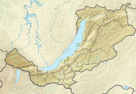
Kangarulsky range ( brown . Hamar Khuduyn Daban ) - a mountain range in Buryatia to the west of Khamar-Daban . The length is about 80 km. Width - up to 20 km. The highest point is Mount New Halburtuy (2623 m).
| Khangarul Range | |
|---|---|
| Boer. Hamar Khuduyn Dabaan | |
| Specifications | |
| Length | about 80 km |
| Width | about 20 km |
| Highest point | |
| Highest peak | New Halburtuy |
| Absolute height | 2623 m |
| Location | |
| A country |
|
| The subject of the Russian Federation | Buryatia |
| Mountain system | South Siberian mountains |

Description
It is a watershed of the Irkut river basins (to the north) and Dzhida (to the south). The administrative border of the Tunkinsky and Zakamensky districts of the Republic of Buryatia runs along the ridge. Several paths have been laid across the ridge, the most involved of them running in the central part through the Khamar-Khuduy pass and connecting along the Ehe-Khudui and Zun- Muren rivers of the Tunkinskaya valley with Zakamnaya. In the past, there was a livestock path in the eastern extremity of the ridge up the Tsakirka River from the village of Dalahai through the upper reaches of the Khangarul and further down the Utulik to the Trans-Siberian Railway .
According to geomorphology, researchers do not have a common opinion on whether the ridge belongs to any mountain system - whether to refer it to Khamar-Daban or to allocate it to a separate ridge to the south-east of the Great Sayan , along with the Bukhurik, Zangisansky, Urudeevsky, etc. ridges.
The ridge departs to the west in the latitudinal direction from the mountain node in the headwaters of Khangarul (from which is the official name of the ridge), Snezhnaya , Tsakirka and Sanginy , perpendicular to the west of the Kammar -Daban watershed, just south of the summit of Subutui (or Utulikskaya Podkivka, 2396 m).
In the west, the ridge approaches perpendicularly to the junction of the Maykhan Tagiin Khiliin Nura ridges, going north along the state border of Russia and Mongolia , and Dzhidinsky , at the mountain Hasin-Ehen-Under (2636 m) departing along the south. In this mountain site originate the major rivers of the region: Zun-Muren , Dzhida , as well as the rivers of the Aegein Gol Basin - Umhay-Gol and Ajig-Gol.
The ridge has rounded, smooth forms, with average altitudes of 2000–2200 meters above sea level. Slopes up to altitudes of 1800–2000 meters are covered mainly by larch taiga , above - alpine meadows and mountain tundras , in places with thickets of dwarf birch . Rivers to the north of the watershed form deep ramified valleys, and on the southern side of the river valley it is much more spreading.
The ridge is characterized by a dry climate, due to the internal location relative to the Eastern Sayan and Khamar-Daban, preventing the penetration of humid air masses from the west, north and east, as well as the transfer of dry air here by southerly and southwesterly winds from the inner regions of Mongolia. A small amount of precipitation determines winters with little snow in the region of the ridge.