Lem is a river in Russia , it flows in the Bolshesosnovsky district of the Perm Territory and the Sharkan and Debyosky districts of Udmurtia . The river mouth is located 459 km on the left bank of the Cheptsy . The length of the river is 25 km, the basin area is 174 km².
| Lem | |
|---|---|
| Characteristic | |
| Length | 25 km |
| Pool | 174 km² |
| Watercourse | |
| Source | |
| • Height | above 195.9 m |
| • Coordinates | |
| Mouth | Cap |
| • Location | 459 km on the left bank |
| • Height | below 173.8 m |
| • Coordinates | |
| Location | |
| Water system | Cheptsa → Vyatka → Kama → Volga → Caspian Sea |
| A country |
|
| Regions | Perm region , Udmurtia |
| Areas | Bolshesosnovsky district , Sharkan district , Debyosky district |
| HWR Code | |
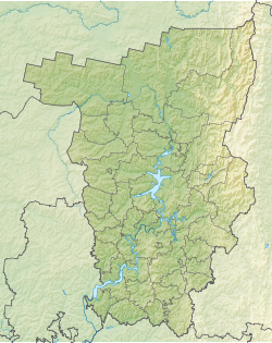
The source of the river in the Sharkan district of Udmurtia, 2 km north of the village of Surona, near the border with the Perm region. The source lies on the watershed of Vyatka and Siva , the Potka River starts nearby. It flows from the source to the northeast, then turns to the north and northwest. Shortly after the source, it flows into the Bolshesosnovsky district of the Perm Territory, through which it makes most of the current, in the lower course it returns to Udmurtia, to the Debyosky district.
Tributaries - Small Kizninka, Big Kizninka, Alembayka, Vyazovka (left); Iganka, Semenkass (right). On the river stands the village Malt and the village Kiprino , Russian Lem (Perm region); Udmurt Lem (Udmurtia). Falls into the Cheptsa opposite the village of Lower Pykhta .
Water Registry Data
According to the state water register of Russia, it belongs to the Kama basin district , the water management section of the river - Cheptsa from its source to the mouth, the river sub basin of the Vyatka river. River basin - Kama .
According to the geographic information system of water management zoning of the territory of the Russian Federation, prepared by the Federal Agency for Water Resources [2] :
- The code of the water body in the state water register is 10010300112111100032394
- Hydrological code (GI) - 111103239
- Pool code - 01/10/0114
- GI Volume Number - 11
- Issue on GI - 1
Notes
- ↑ Surface water resources of the USSR: Hydrological knowledge. T. 11. Middle Ural and Urals. Issue 1. Kama / ed. V.V. Nikolaenko. - L .: Gidrometeoizdat, 1966. - 324 p.
- ↑ State Water Register of the Russian Federation: Lem .
Links
- The article uses information provided by the Federal Agency for Water Resources from the list of water bodies registered in the state water register as of March 29, 2009. List (rar-archive, 3.21 MB).