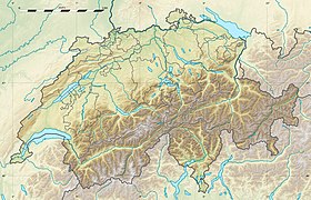
Churfirsten ( Churfirsten ) is a mountain range in the canton of St. Gallen in Switzerland . It forms the natural boundary between the electoral districts of Toggenburg and Sarganserland .
| Kurfirsten | |
|---|---|
| him Churfirsten | |
 View of Churfirsten from the north (September 2006). From left to right: Hinterrugg, Shibenstoll, Zuchtoll, Breezy, Fryumsel, Zelun. | |
| Highest point | |
| Absolute height | 2306 m |
| Location | |
| A country |
|
Kurfirsten is the southernmost part of the Appenzell Alps . From the Glarn Alps the range is separated by the lake Walensee . Mountains Kurfirsten stretched from east to west. Consist of limestone, due to erosion formed several separate peaks. On the south side, the ridge is delineated more sharply, probably due to the impact of the Rhine glacier.
The peaks of the ridge formed the historical boundary of the Bishopric of Chur .
Seven peaks from west to east:
- Zelun ( him Selun ), 2205 m
- Frumsel ( German Frümsel ), 2263 m
- Breezy ( German Brisi ), 2279 m
- Züshtoll ( German Zuestoll ), 2235 m
- Schibenstoll ( German Schibenstoll ), 2234 m
- Hinterrugg ( German Hinterrugg ), 2306 m
- Keserrugg ( German Chäserrugg ), 2262 m.
Sometimes Kizerrugug is considered part of the Hinterugg peak, since the relative height of the top of the first is only 14 m. To the west and east of the listed peaks there are peaks of lesser heights. To the west of Zieluna there are the mountains Wart ( German Wart , 2068 m), Scheren ( German Schären , 2184 m), Negeliberg ( German Nägeliberg , 2153 m), Glatthamm ( German Glattchamm , 2084 m), Leisthamm ( German. Leistchamm , 2101 m). The peaks of Tristenkolben (Ger . Tristenkolben , 2159 m), Gamzerrugg ( Ger . Gamserrugg , 2076 m) are located to the east of Kaserrugg.
Links
- www.wanderland.ch Unsolved (not available link) . Archived July 14, 2014.
- www.hikr.org
- idiotikon.ch
- quaternary-science.publiss.net

