The Borgoi ridge ( drill. Borgoyn dabaan ) is a ridge in the physical and geographical region of the Selenginsky highlands in the Dzhidinsky and Selenginsky districts of Buryatia .
| Borgoysky Range | |
|---|---|
| Boer. Borgoyne dabaan | |
| Specifications | |
| Length | 67 km |
| Width | 10-19 km |
| Highest point | |
| Highest peak | Athatui |
| Absolute height | 1240 m |
| Location | |
| A country |
|
| The subject of the Russian Federation | Buryatia |

Content
Description
The ridge is 67 km long and 10-19 km wide. The highest point is Mount Athatui (1240 m). The average height of the watershed ridge is 1000 m, passes - 800 m. The ridge is composed of granites , gneisses and volcanic rocks of different ages.
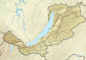
It stretches from the Borgoy steppe in the southwest to the valley of the lower reaches of the Chikoy River in the northeast. The Selenga River divides the ridge into two equal parts, cutting it from south to north. In the south, the slopes of the ridge descend to the valley of the lower reaches of the Dzhida River, in the north - to the Selenga. The spurs of the ridge west of the Selenga are partly part of the nature protection zone of the Atsulsky reserve of republican significance.
The ridges, as well as the western and eastern slopes, are mostly covered with pine forests, in the pads there are steppes with groves of deciduous trees ( birch , small-leaved elm , aspen , etc.). On the southwestern and southern slopes are dry steppes . On the banks of the Selenga common bird cherry grow, buckthorn buckthorn .
In the forests of the Borgoysky ridge there are Manchurian deer , wild boar , roe deer , wolf , fox , and hare [1] .
The ridge is relatively anhydrous; there are key outlets. Water flows are formed only during the spring melting of snows and rains of late summer - early autumn.
Transportation Network
At the southwestern end, along the small pass, the ridge crosses the regional highway P440 Gusinoozersk - Zakamensk. Along the northeastern spurs of the ridge along the valley of the Chikoi River passes the federal highway A340 Ulan-Ude - Kyakhta. In the central part, on the left, western, bank of the Selenga, the ridge crosses the southern line of the East Siberian railway Ulan-Ude - Naushki [2] ( Trans-Mongolian railway ).
Settlements
At the foot of the northern spurs of the Borgoy Range there are settlements of the Selenginsky district: Sosnovka , Selenduma , Bilyutay , Enhor . On the southern spurs is the Nur-Tukhum ulus.
Notes
- ↑ BU Burpriroda. (inaccessible link) . Date of treatment July 8, 2015. Archived March 4, 2016.
- ↑ Photo of a train crossing the Borgoy Range ...
Links
- The Borgoy Range. Siberian Soviet Encyclopedia - 1929. (Unavailable link) . Archived March 4, 2016.
- The nature of Baikal. Borgoysky ridge.