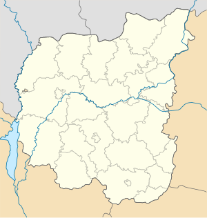
Chernihiv Oblast ( Ukrainian. Chernihіvska Oblast ) - the region in the north of Ukraine . It borders in the west with the Kiev region , in the north - with the Gomel region of Belarus and the Bryansk region of the Russian Federation , in the east - with the Sumy region , in the south - with the Poltava regions of Ukraine.
| Region | |||||
| Chernihiv region | |||||
|---|---|---|---|---|---|
| ukr Chernigivska region | |||||
| |||||
| A country | |||||
| Includes | 22 districts, 15 cities, 30 towns, 1488 villages | ||||
| Adm Centre | Chernigov | ||||
| Head of Regional State Administration | Natalya Andreevna Romanova | ||||
| Head of the Regional Council | Igor Stanislavovich Vdovenko | ||||
| History and geography | |||||
| Date of education | October 15, 1932 | ||||
| Square | 31,903 [1] km² (5.29%, 3rd place ) | ||||
Height
|
| ||||
| Timezone | EET ( UTC + 2 , in summer UTC + 3 ) | ||||
| The largest city | Chernigov | ||||
| Dr. big cities | Nezhin , Priluki | ||||
| Population | |||||
| Population | 994 401 [2] people ( 2019 ) | ||||
| Density | 31.5 p / km² | ||||
| Nationalities | Ukrainians 93.5%, Russians 5%, Belarusians 0.6%, other 0.9% | ||||
| Official language | Ukrainian | ||||
| Digital identifiers | |||||
| ISO 3166-2 code | UA-74 | ||||
| Telephone code | +380 46 | ||||
| Zip Codes | 14xxx, 15xxx, 16xxx, 17xxx | ||||
| Internet domain | chernigov.ua; cn.ua | ||||
| Automat code numbers | NE | ||||
| Koatuu | 7400000000 all codes | ||||
| Official site | |||||
 | |||||
 | |||||


Content
Geography
Relief
The region is entirely located on the territory of the East European Plain . This explains the flat nature of the relief with insignificant absolute heights (mainly 50-150 meters above sea level).
Hydrology
1,200 rivers with a total length of about 8.5 thousand km flow through the territory of the Chernihiv region. The largest rivers are the Dnieper , the Desna , the Sejm , the Oster , the Dreams , the Ubed , the Udai , the Daughter , the Strizhen .
Chernihiv region has significant tourist potential. In the area there are 610 natural reserve objects. On the territory of the Chernihiv region there are two national natural parks - Ichnyansky and Mezinsky ; and one regional landscape park - Mezhrechensky . On the territory of the region there are animals listed in the Red Book of Ukraine: aurochs , a large jerboa , a small bat and a big one, a steppe ferret ; Steppe crane , owl , bustard and others.
History
The monuments of Chulatovo 3 (Zarovsk Kruch), Yazvi, Arapovichi, Orehovy Log, Mosolov Rov [3] belong to the Middle Paleolithic in the Chernihiv region.
More than 20 settlements of the Late Paleolithic era (35–10 thousand years ago) were discovered by archeologists in the region ( Pushkari I , Pushkari IX, Mezinskaya Site , [4] ), Buzhanka, [5] and etc.).
The Bronze Age (2 millennium BC) includes settlements found in the Yalovschina and Tatar Hill Gorky tracts.
By 1 millennium n. er include settlements of northerners , located on the banks of the Desna and Strizhnya.
In the 9th century, Chernihiv-Severshchina became part of Kievan Rus , and Chernigov was second only to Kiev in development.
The main role in the economy was played by agriculture. High development reached crafts. The largest ancient settlement and “burial ground of the Varangians” in Kievan Rus of the 9th — 12th centuries, apparently, is the Shestovitsky archaeological complex near Chernigov. In Novgorod-Seversky, archeologists discovered glass bracelets of the period of Ancient Russia and wrote XII century, which scratched the letters on the bark or wax tablets [6] . From 1156 to 1239, the city of Berezay was part of the Principality of Vshchizhsky .
In 1796, the Little Russian Province of the Russian Empire was formed, which in 1802 was divided into Chernihiv and Poltava provinces. After a series of administrative reforms of 1919-1932, on October 15, 1932, the Chernihiv region was formed as part of the Ukrainian SSR . January 10, 1939 decree of the Presidium of the Supreme Soviet of the USSR from the area withdrawn and transferred to the newly formed Sumy region Burynsky, Glinsky, Glukhov, Dubovyazovsky, Konotop, Krolevetsky, Nedrigaylovsky, Putivl, Romny, mid-Budsky, Smelovsky, Talalaivka, Hilchitsky, Hearts, Shalyginsky , Shostkinsky and Yampolsky districts. Since 1991 - as part of Ukraine.
Population
- The level of urbanization (for 2001): urban population - 727.2 thousand people. - 58.4%, rural population - 518.1 thousand people. - 41.6%.
- The level of urbanization (for 2007): urban population - 690.5 thousand - 60.4%, rural population - 452.9 thousand - 39.6%.
- National composition according to official data (for 2001): Ukrainians 93.5%, Russians 5.0%, Belarusians 0.6%, others 0.9%.
As of February 1, 2015, the actual population of the region was 1,054,626 people, including the urban population — 678,603 people (64.35%) and the rural population — 376,023 people (35.65%). The permanent population is 1,046,084 people, including the urban population 668,369 people (63.89%), the rural population 377,715 people (36.11%). The population of the regional center was 294,614 people (27.94% of the population of the region) [2] .
Administrative-territorial unit
General Information
The administrative center of the Chernihiv region is the city of Chernihiv .
The number of administrative units, councils and settlements of the region:
- rural areas - 22;
- urban districts - 2;
- settlements - 1530, including:
- rural - 1488, including:
- settlements - 60;
- villages - 1425;
- urban - 45, including:
- urban-type settlements - 29;
- cities - 15, including:
- cities of regional importance - 4;
- cities of regional significance - 12;
- cities with district divisions - 1;
- rural - 1488, including:
- township councils - 28;
- village councils - 525.
The local government in the region is carried out by the Chernihiv Regional Council, the executive power is the regional state administration. The head of the region is the chairman of the regional state administration, appointed by the President of Ukraine .
Areas
In Chernihiv region 22 district:
|
|
Cities
Cities of regional significance:
- Chernigov
- Nezhin
- Priluki
- Novgorod-Seversky
Cities of regional significance:
|
|
| Localities with the number of inhabitants over 5 thousand as of November 1, 2017 [7] [8] | ||||||||||||||||||||||||||||||||||||||||||||||||
|
Economy
| N | indicator | units | value, 2014 |
|---|---|---|---|
| one | Export of goods | million USD | 700.0 [9] |
| 2 | Ud.ves in all-Ukrainian | % | 1,3 |
| 3 | Import of goods | million USD | 528.1 [9] |
| four | Ud.ves in all-Ukrainian | % | 1.0 |
| five | Balance export - import | million USD | 172.0 [9] |
| 6 | Capital investment | million hryvnia | 2431.1 [10] |
| 7 | Average salary | uah | 2690 [11] |
| eight | Average salary [12] | US dollars | 226.3 [13] |
According to the materials of the Committee of Statistics of Ukraine (ukr.) And the General Directorate of Statistics in the Chernihiv region (ukr.)
Industry
Chernihiv , Nezhin , Priluki and Bakhmach are the main industrial centers of the region. Mechanical engineering, chemical, woodworking, light and food are the leading sectors of the economy. In the production of meat and milk per capita in 2000, Chernihiv region is among the top five. In the extreme west and in some places in the north are forests (20% of the land fund). Through the territory of the region runs the Dnieper-Donetsk oil and gas region .
| Mineral resource | Place of Birth |
|---|---|
| Oil | Prilutsk, Matlahovskoe , Romashovskoe |
| Oil and gas condensate | Skorokhodovskoe , Lelyakovskoe , Gnedinskoe |
| Gas condensate | Talalaevskoe , Nikolaevskoye |
| Peat | Zamglay |
| Quartz sand | Papirnyanskoe |
| a piece of chalk | Novgorod-Severskoy |
| Clay | Novgorod-Severskoy |
Agriculture
The agro-industrial complex is represented: in the north, west - meat and dairy cattle breeding , grain farming , potato growing and flax growing ; in the south, the center is meat and dairy cattle breeding , pig breeding , grain farming and beet breeding . In the agrarian complex plant growing prevails. Main crops: cereals : winter wheat , rye , barley , oats , corn , buckwheat ; technical : flax , sugar beet ; fodder : corn for silage and green fodder, alfalfa , stable ; vegetable : carrots , table beets , cabbage , cucumbers , tomatoes . Horticulture and berry growing are also developed. Present fishing and beekeeping .
Notes
- ↑ Statistic Ukraine Registrar 2016. Part-I / For the editors І. M. Zhuk. Vіdpovіdalnyy for vipusk M. B. Tymonina. - K .: State Statistics Service of Ukraine , 2016. - P. 261. (Ukr.)
- ↑ 1 2 Population size as of March 1, 2019
- ↑ Belyaev, V.I., Gribchenko, Yu.N., Kulakovskaya, L.V., Usik, V.I. Mosolov, Moat of the Middle Paleolithic Age at Desna, Proceedings of the Faculty of History, St. Petersburg University, 2014
- ↑ Kedun I.S., Chubur A.A. A new paleoanthropological find in the Middle Poves'ene: geological and archaeological context // Anthropology Bulletin. 2011. Vol. 19. - pp. 77-84.
- ↑ Paleolithic Upper Dnieper (inaccessible link)
- ↑ The cave site of the Paleolithic time found in Novgorod-Seversky, 07/14/2010.
- ↑ Main demographic indicators in cities and districts of the Chernihiv region in January – October 2017 (ukr.) Main Department of Statistics in the Chernihiv region.
- ↑ In determining the dynamics of population, the change from October 1 to November 1, 2017 was taken into account
- ↑ 1 2 3 Geographic structure of foreign trade in goods of the region for 2014 (Ukr.)
- Capital investment by type of assets for January - December 2014 (ukr.)
- ↑ The average monthly wage of full-time employees in cities and districts of the Chernihiv region for January - December 2014 (ukr.)
- ↑ The official NBU hryvnia rate (average for the period) (Ukr.)
- ↑ Course 11.8867 for 2014