Kema is a river in the Vologda Oblast of Russia , flows into Lake Beloe , belongs to the Volga basin. The length of the river is 150 km, the catchment area is 4480 km², and the average discharge is 44.8 m³ / s.
| Kema | |
|---|---|
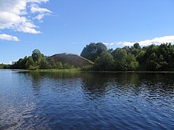 Kema River near Mizhhir Kema River near Mizhhir | |
| Characteristic | |
| Length | 150 km |
| Swimming pool | 4480 km² |
| Water consumption | 44.8 m³ / s (near the village of Levkovo ) |
| Watercourse | |
| Source | Kem Lake |
| • Height | 160 m |
| • Coordinates | |
| Mouth | White lake |
| • Height | 113.3 m |
| • Coordinates | |
| Location | |
| Water system | Sheksna → Volga → Caspian Sea |
| A country |
|
| Region | Vologodskaya Oblast |
| HWR code | |


The largest tributaries: Indomanka (left); Korba (right).
The source of the river is on the Andom Upland . Kema flows from Lake Kemsky near the village of Ilyina on the territory of the Kemsky rural settlement of Vytegorsky district of the Vologda region . In the upper reaches on the banks of Kema are the villages of Yevsinskaya , Borisovo , the Great Court , the river flows south through a largely uninhabited area. The course is fast, in the channel rifts and rapids. The banks of Kema are wooded, in some places swampy. 21 km from the source, the left tributary of the Okstamka flows into Kemu.
In the middle reaches is the village of Mirny , here the right tributary of the Newksha flows into Kemu. Further, the river flows for some time along the A119 highway , along the banks are the villages of Tatarikha , Kabetsovo , Kuznetsovo , Ignatovo .
In the village of Mironovo, Kema accepts the left tributary of the Sheyruchi , then the right tributaries of the Fominsky, Korba . After crossing the border of the Andreevsky rural settlement of Vashkinsky district, the number of villages on the banks of Kema increases. In the confluence area of the left tributary of the Indomanka , the villages of Nikonovo , Nefedovo , Troshino , Matveeva Gora , Moseevo , Bosovo are located , at the mouth of the Suki village Shugino . Near Shugino, the channel turns west and crosses the border of the Piksimov rural settlement . After the confluence of the right tributary of the Kolman (Regensky) stream near the village of Popovka , the territory of the Porechensky rural settlement begins. Here on the river are the village of Bonga , the villages of Levino , Harbovo , Podgornaya , Kostino .
In the lower reaches, near the villages of Pokrovskoye and Nikolskoye, the Pokrovsky rural settlement, the river turns south and expands sharply, gradually turning into a bay in the northwestern part of White Lake . Not far from the mouth of Kema is the village of Novokemsky .
In the lower reaches of Kema is the village of Nikolskoye V , dating from the first half of the X century - the beginning of the XI century [2] [3] .
Gallery
Kema north of Lake White.
Kema north of Lake White.
Kema in the Vytegra district.
Notes
- ↑ Surface Water Resources of the USSR: Hydrological Understanding. T. 10. Upper Volga region / ed. V.P. Shaban. - L .: Gidrometeoizdat, 1966 .-- 528 p.
- ↑ New field studies of medieval monuments of Belozerya
- ↑ New studies of medieval monuments of central Belozerya
Links
- G.A. Vorobyov. Kema // Vologda Encyclopedia / Ch. ed. G.V. Sudakov . - Vologda: Russia, 2006 .-- S. 240 . - ISBN 5-87822-305-8 .
- Site about the village of Pokrovskoye on Keme
- Site of Novokemsky village
- State Water Register: Kema . Archived February 22, 2012.