Veps Upland (traditionally used name - Veps Upland ) is a hill in the north of the East European Plain .
| Veps Upland | |
|---|---|
| Highest point | |
| Highest point | 304 m |
| Location | |
| A country |
|
| Subjects of the Russian Federation | Vologda Oblast , Leningrad Oblast |
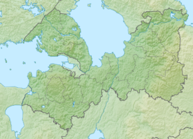
It is located in the west of the Vologda region ( Vytegorsky district ) and in the east of the Leningrad region ( Podporozhsky , Boksitogorsky , Tikhvin districts) [1]
The highest point is Mount Malgore [2] with a height of 304 m above sea level, located on the territory of Vytegorsky district of the Vologda region.
In the Leningrad region, the highest point is Mount Gapselga. Height 291 meters above sea level. [3]
At the base of the hill there is a swell-like structural uplift; the rocks of the Carboniferous system are overlain by glacial and ice -ice deposits. Hilly moraine and kama relief, characterized by karst funnels ; many lakes, including “periodically disappearing” ones, their conservation is one of the tasks of the Shimozersky State Hydrological Nature Reserve established in 1978 [4] .
Usually included in the Valdai Upland .
The main rivers are the Shoksha , Oyat , Kapsha , Pasha , Tutoka and Yavosma .
Notes
- ↑ Enotov Nikolay . Veppsky mountains.
- ↑ Mount Malgory .
- ↑ Enotov Nikolay . Veps mountains.
- ↑ Specially protected natural territories of Russia. Shimozersky reserve .
Links
- Vorobyov G.A. Vepsovskaya Upland // Vologda Encyclopedia / Ch. ed. G.V. Sudakov . - Vologda: Russia, 2006 .-- S. 97 . - ISBN 5-87822-305-8 .
- Vepsov Upland // Great Soviet Encyclopedia : [in 30 vol.] / Ch. ed. A.M. Prokhorov . - 3rd ed. - M .: Soviet Encyclopedia, 1969-1978. .
- The rivers of the Veps Upland .