Stoyanovshchina - a village in the Luga urban settlement of the Luga district of the Leningrad region .
| Village | |
| Stoyanovshchina | |
|---|---|
| A country | |
| Subject of the federation | Leningrad region |
| Municipal District | Luga |
| Urban settlement | Luzhskoye |
| History and Geography | |
| Former names | Svyatkovo |
| Timezone | UTC + 3 |
| Population | |
| Population | ▲ 13 [1] people ( 2017 ) |
| Digital identifiers | |
| Telephone code | +7 81372 |
| Postcode | 188289 |
| OKATO Code | 41233824013 |
| OKTMO Code | |

History
The village of Stoyanovschina is mentioned on the map of the St. Petersburg province of F. F. Schubert in 1834 [2] .
STOYANOVSHCHINA - the village belongs to the captain-lieutenant of the fleet Peter Goering, the number of inhabitants according to the audit: 24 m. p. [3] (1838)
STOYANOVSHCHINA - the village of Herr Goering, on a country road, the number of yards - 8, the number of souls - 42 m. [4] (1856)
STOYANOVSHCHINA (SVYATKOVO) - a village, the number of inhabitants according to the Xth revision of 1857: 28 m. P., 25 w. p. [5]
STOYANOVSHCHINA - possessive village with a key, the number of yards - 8, the number of inhabitants: 41 m., 40 w. p. [6] . (1862 year)
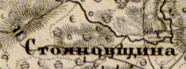
The village of Stoyanovschina on the map of 1863

According to the 1882 farmstead inventory:
STOYANOVSCHINA (SVYATKOVO) - village of Smerdovsky society of Kologorodsky volost
houses - 13, allotments for showers - 28, families - 17, number of inhabitants - 33 m. P.; category of peasants - owners [5]
In the XIX - early XX centuries, the village administratively belonged to the Kologorodsky volost of the 2nd zemsky section of the 2nd camp of the Luga district of St. Petersburg province.
According to the "Memorial Book of the St. Petersburg Province" for 1905, the village of Stoyanovschina was part of the Smerdovsky rural society [7] .
According to the topographic map of 1926, the village consisted of 14 peasant households .
According to 1933, the village of Stoyanovschina was part of the Smerdovsky village council of the Luga region [8] .
According to 1966, the village of Stoyanovschina was also part of the Smerdovsky village council [9] .
According to 1973, the village of Stoyanovschina was part of the Kalganovo village council [10] .
According to 1990 data, the village of Stoyanovschina was part of the Intergovernmental Village Council [11] .
In 1997, 11 people lived in the village of Stoyanovshchina of the Intergovernmental Volost, in 2002 - also 11 people (all Russians) [12] [13] .
In 2007, 13 people lived in the village of Stoyanovschina of the Luzhsky state enterprise [14] .
Geography
The village is located in the southern part of the district on the highway Green Bor - Stoyanovschina.
The distance to the administrative center of the settlement is 9 km [14] .
The distance to the nearest railway station Luga - 12 km [9] .
Demographics
| Population | ||||
|---|---|---|---|---|
| 1838 | 1862 | 1997 | 2007 [15] | 2010 [16] |
| 51 | ↗ 81 | ↘ 11 | ↗ 13 | ↘ 3 |

Streets
Country, Railway, Flower [17] .
Notes
- ↑ Administrative and territorial division of the Leningrad region / Comp. Kozhevnikov V.G. - Directory. - SPb. : Inkeri, 2017 .-- S. 136. - 271 p. - 3000 copies. Archived March 14, 2018 on Wayback Machine
- ↑ Topographic map of St. Petersburg province. 5th layout. Schubert. 1834
- ↑ Description of the St. Petersburg province in counties and camps . - SPb. : Provincial Printing House, 1838. - P. 114. - 144 p.
- ↑ Luga district // Alphabetical list of villages by counties and camps of the St. Petersburg province / N. Elagin. - SPb. : Printing House of the Provincial Government, 1856. - S. 138. - 152 p.
- ↑ 1 2 Materials on national economy statistics in the St. Petersburg province. Issue VI. Peasant farming in the Luga district. Part one. Tables. SPb. 1889, p. 110
- ↑ "Lists of the populated areas of the Russian Empire, compiled and published by the Central Statistical Committee of the Ministry of the Interior" XXXVII St. Petersburg Province. As of 1862. SPb. ed. 1864 p. 86 Archived on September 24, 2015.
- ↑ “Memorial book of the St. Petersburg province. 1905 ", p. 154
- ↑ Administrative territorial division of the Leningrad region. - L., 1933, p. 271 Archived on October 17, 2013.
- ↑ 1 2 Administrative and territorial division of the Leningrad region / Comp. T.A. Badina. - Reference book. - L .: Lenizdat , 1966 .-- S. 176. - 197 p. - 8000 copies. Archived October 17, 2013. Archived October 17, 2013 on Wayback Machine
- ↑ Administrative territorial division of the Leningrad region. - Lenizdat, 1973, p. 245 Archived on March 30, 2016.
- ↑ Administrative territorial division of the Leningrad region. - Lenizdat, 1990, ISBN 5-289-00612-5, p. 92 Archived October 17, 2013.
- ↑ Koryakov Yu. B. Database “Ethno-linguistic composition of Russian settlements”. Leningrad region .
- ↑ Administrative territorial division of the Leningrad region. - SPb, 1997, ISBN 5-86153-055-6, p. 91; Archived October 17, 2013.
- ↑ 1 2 Administrative and territorial division of the Leningrad Region. - SPb., 2007, p. 112 Archived on October 17, 2013.
- ↑ Administrative territorial division of the Leningrad Region: [reference.] / Under the general. ed. V.A. Skorobogatova, V.V. Pavlova; comp. V. G. Kozhevnikov. - SPb., 2007. - 281 p. . Date of treatment April 26, 2015. Archived April 26, 2015.
- ↑ 2010 All-Russian Population Census. Leningrad region . Date of treatment August 10, 2014. Archived on August 10, 2014.
- ↑ Postcodes. Luga district, Leningrad region.