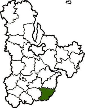
Bohuslav district ( ukr. Bohuslav district ) is an administrative unit in the south of Kiev region of Ukraine . The administrative center is the city of Bohuslav .
| area | |||||
| Boguslav district | |||||
|---|---|---|---|---|---|
| Boguslavsky district | |||||
| |||||
| A country | Ukraine | ||||
| Enters into | Kiev region | ||||
| Adm Centre | Bohuslav | ||||
| Head of district council | Nikolai Vasilievich Evtushenko [1] | ||||
| History and geography | |||||
| Square | 772 km² | ||||
| Timezone | EET ( UTC + 2 , in summer UTC + 3 ) | ||||
| Population | |||||
| Population | 34 305 [2] people ( 2017 ) | ||||
| Official language | Ukrainian | ||||
 | |||||
![Flag [d]](http://upload.wikimedia.org/wikipedia/commons/thumb/b/b0/Flag_of_Bohuslav_raion.svg/160px-Flag_of_Bohuslav_raion.svg.png)
![Coat of arms [d]](http://upload.wikimedia.org/wikipedia/commons/thumb/5/5a/Bohuslav_rayon_herb.png/90px-Bohuslav_rayon_herb.png)
Content
Geography
The area is 772 km 2 .
The district is bordered in the north with Mironovsky , in the north-west - with Rakitnyansky districts of Kiev region , in the south - with Lysyansky district of Cherkasy region , in the west - with Tarashchansky district of Kiev region, in the east - with Korsun-Shevchenkovsky and Kanevsky districts of Cherkassy region.
The main rivers are the Ros .
History
The territory of Boguslavshchyna has been inhabited for a long time. In the tract Gorodok three Roman coins of the 2nd century AD were found. e, and near the city, remains of an ancient Russian fortification of the 11th - 13th centuries , which can be identified with the city of Bohuslav mentioned in the chronicles. He was along with Korsun and Kanev one of the largest fortified points on the southern border of Russia.
The regional center - the city of Boguslav was founded in 1032 by the prince of Kiev Yaroslav the Wise. In 1240, Boguslav was destroyed by the Mongol-Tatar hordes . In 1362, the territory of the region was ruled by Lithuania, and after the Union of Lublin in 1569 - under the rule of the Polish Kingdom. At the beginning of the seventeenth century received the Magdeburg Law .
In 1648, Boguslav, liberated by the troops of Bogdan Khmelnitsky and was the hundredth town of the Belotserkovsky regiment. In 1667, Boguslav stepped back to Poland, according to the Eternal Peace of 1686. Destroyed by previous wars right bank remains uninhabited and no one. But in the 1680s, the Poles allowed the Cossacks under the leadership of Semyon Paliy to settle the Kiev region, Boguslav became the regimental city of the Boguslavsky regiment. In 1712 the Cossack autonomy was liquidated.
In 1793, after the second division of the Polish-Lithuanian Commonwealth, the region became part of Russia. In the years 1796-1837 - the city of Bohuslav is the center of the Bohuslav district . Since 1846, this territory is part of the Kanev district of the Kiev province.
Soviet power was established in January 1918 (finally, since 1920), since 1919 Bohuslav is the center of the Bohuslav district of the Kiev province.
Since July 1941, Boguslav and the area has been occupied by the German fascist invaders. In February 1944 the district was liberated.
In September 1991, the flag of independent Ukraine was raised above the premises of the district executive committee and the city council.
Demographics
The population of the district is 40 575 people (data of 2006 ), including about 16 911 people living in urban areas. There are a total of 41 settlements.
Administrative Device
Number of tips:
- urban - 1
- rural - 21
Number of settlements:
- District cities - 1
- villages - 40
Locations
A complete list of localities in the area, sorted alphabetically, is at the bottom of the page.
|
|
Policy
Economy
Transportation
Culture
Attractions
Links
Notes
- ↑ The official website of the administration of the Kiev region / Administration of the Boguslavsky district Archival copy of March 6, 2016 on the Wayback Machine (ukr.)
- ↑ Number of population (for population) for 1 June 2017 to the rock // Head of the statistics department in Kyiv region