Baykonyr [1] [2] ( Bulanty [1] ; Kazakh. Bayқққyr ) is a river in the Ulytau district of the Karaganda region of Kazakhstan .
| Baikonyr | |
|---|---|
| kaz. Bayқoңyr | |
| Characteristic | |
| Length | 235 km |
| Pool | 4940 km² |
| Water consumption | 0.85 m³ / s |
| Watercourse | |
| Source | |
| • Coordinates | |
| Mouth | Schubarteniz |
| • Coordinates | |
| Location | |
| A country |
|
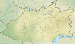
| Region | Karaganda region |
| Area | Ulytau district |
Formed by the confluence of the Kurambai (Kuanbai) and Aktas rivers flowing from the Ulytau ridge. It falls into the salt lake Shubarteniz . The length of the river is 235 km, the catchment area is 4940 km². The width of the floodplain valley is 0.05-2 km. The average annual water flow rate is 0.85 m³ / s.
The food of the river is snowy. The water is fresh, but in summer, with a decrease in water level, salinity increases. In summer, the river dries up, leaving only small lakes in the deepest places [3] .
On the river is the village of Baikonur , which gave the name to the cosmodrome .
Petroglyphs were found on the rocks on both banks of the river [3] .
Near the river in 1728, the Bulantin battle of the Kazakh-Dzungarian war took place , which ended with the victory of the Kazakhs.
Notes
- ↑ 1 2 Map sheet L-41 .
- ↑ Map sheet L-41-5 Akshakum well . Scale: 1: 100,000. Status of the terrain for 1956. 1958 edition
- ↑ 1 2 Novozhenov V.A. Petroglyphs of Sarah Arka. - Almaty: 2002 .-- 125 s.
Literature
- Baykonyr // Kazakhstan. National Encyclopedia . - Almaty: Kazakh encyclopedias , 2004. - T. I. - ISBN 9965-9389-9-7 .
When writing this article, material from the publication Kazakhstan. National Encyclopedia ”(1998-2007), provided by the editors of the“ Kazakh Encyclopedia ”under a Creative Commons BY-SA 3.0 Unported license .