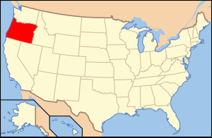
Malur County is located in Oregon , USA . It was officially formed on February 17 , 1887 . As of 2010 , the population was 31,313.
| district | |
| Malur County, Oregon | |
|---|---|
| Malheur County, Oregon | |
| A country | USA |
| Included in | Oregon |
| Adm. center | Vale, Oregon |
| History and Geography | |
| Date of formation | 1887 |
| Area | 25 718,726 km² |
| The largest city | Ontario, Oregon |
| Population | |
| Population | 31 313 people ( 2010 ) |
| Official language | English |
| Official site | |
 | |
 | |
Content
- 1 Geography
- 1.1 Neighboring Counties
- 2 population
- 3 notes
- 4 References
Geography
According to the United States Census Bureau , the total area of the county is 25,718.726 km 2 , of which 25 607.356 km 2 are land and 111.370 km 2 or 0.430% are in water bodies.
Neighboring Counties
The district is bordered by three counties of "its" state ( Harney , Baker and Grant), as well as several, belonging to the states of Idaho ( Washington , Kenyon, Payette and Owaihi) and Nevada ( Humboldt County ).
Part of Malur belongs to another time zone (not Mountain, but Pacific Time ). A number of major highways pass through the district; several national parks are located on its territory.
Population
According to the 2000 census [1] , 31,615 residents of 10,221 households and 7,348 families live in the okrug. The population density is 1.20 people per km 2 . There are 11,233 residential buildings in the district, with a building density of about 0.40 buildings per km 2 . Racial composition of the population: white - 75.78%, African Americans - 1.22%, Native Americans ( Indians ) - 1.02%, Asians - 1.96%, Hawaiians - 0.08%, representatives of other races - 17.38 %, representatives of two or more races - 2.56%. Hispanics accounted for 25.62% of the population, regardless of race .
Of the total number of households , 36.20% are children under the age of 18 years, 57.30% of households are married couples living together, 10.40% of households are single women without a spouse, 28.10% of households households are not related to families , 23.70% of households consist of one person, 12.00% of households consist of elderly people (65 years and older) living alone. The average household size is 2.77 people and the average family size is 3.28 people.
The age structure of the district: 27.60% under the age of 18, 10.60% from 18 to 24, 27.20% from 25 to 44, 21.00% from 45 to 64, and 21.00% from 65 and older. The average age of a resident of the district is 34 years. For every 100 females there are 116.00 males . For every 100 females age 18 and over, there are 121.20 males .
The average household income in the district was 30,241 USD , per family - 35,672 USD . The average male earnings were 25,489 USD against 21,764 USD for a woman . The per capita income was 13,895 USD . About 14.60% of families and 18.60% of the total population were below the poverty line , including 25.80% of youth (those who were not yet 18 years old) and 11.60% of those who were already over 65 years old .
Notes
- ↑ Data from the United States Census Bureau for Malur County (Oregon) (English) (link not available) . Date of treatment November 16, 2009. Archived April 11, 2012.