Lybed ( Ukr. Libіd ) - a river, the right tributary of the Dnieper . It flows through the territory of Kiev .
| The swans | |
|---|---|
| Ukrainian Libid | |
 mouth mouth | |
| Characteristic | |
| Length | 16 km |
| Swimming pool | 67 km² |
| Water consumption | 1 m³ / s |
| Watercourse | |
| Source(T) (B) | |
| • Location | Otradny (area in Kiev) |
| • Height | 185 m |
| • Coordinates | |
| Mouth | Dnieper |
| • Coordinates | |
| Location | |
| Water system | Dnipro → Black Sea |
| A country |
|
| Region | Kiev |

Content
- 1 Origin of the name
- 2 Physical and geographical data
- 3 notes
- 4 See also
- 5 Literature
- 6 References
Name Origin
It is believed that the river was named after the sister of the legendary founding brothers of Kiev - Kia , Schek and Horeb . The name Lybed is usually raised to the words “swan”, “love” and “lyb” (“raw place”).
It was first mentioned in the annals under 968: "Do not give your horse a drink on Lybed."
Physical and geographic data
Lybed River near A. Gaidar Street
The place where the Wet Stream flows into the Lybed
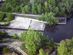
Roll on Lybedi
In different sources, the source of the river is called springs located near the Kiev-Volynsky railway station, or the lake in the Otradny park of the Solomensky district of Kiev, where a hydrological natural monument was created. The source of the Lybed River . However, a more convincing approach seems to be that the source of the river is considered to be the beginning of the reservoir farthest from the mouth, since the first two options indicate the place where the river flow to the surface from the reservoirs. According to this approach, the source of Lybedi is located at the crossroads of Radishchev and Svetlogorskaya streets, not far from Lepse Boulevard on Otradnoye (historical site of Kiev). Source coordinates: The river flows through the territory of the Solomensky , Goloseevsky and Pechersky districts of Kiev, first in the north-east, then in the south-east direction and flows into the Dnieper south of Vydubychi in the Korchevaty district. Length - 16.0 km [1] , (according to other sources, 14 km [2] ) the basin area is 66.2 km² [1] , (according to other sources 68 km² [2] ). Food mainly snow, rain, as well as underground runoff.
The river valley is deeply cut by numerous ravines with steep slopes, on which there are numerous keys - Buslovsky on Sapernaya Slobodka (it is believed that Buslovsky actually flows along Timiryazevskaya Street, just on Busova Gora, and flows not into Lybed, but into the Dnieper) , Lukrets - under the Maiden Mountain, Zywiec - under the mountain Busovitsa, etc.
The main tributaries of Lybedi are the left: Sandy stream , Skomorokh , Botanic stream , Clov , Yamka , Pankovsky stream, Buslovka ; the right ones are the Otradny brook , the Vershinka , the Mokry brook , the Protasov Yar brook , Sovka , Orekhovatka , etc. Most of the tributaries, like Lybed itself, are enclosed in reservoirs, many tributaries have a periodic flow.
In ancient times, Lybed was a full-flowing river that served as the southern, southwestern border of Kiev. Numerous dams and fish were found on the river.
Nowadays, Lybed and its tributaries are a zone of ecological disaster . River water is heavily polluted, runoff decreased, from a full-flowing river Lybed it turned into a stream that receives street storm drains and drains of industrial enterprises.
On a single stretch of the river outside the canalized channel, a complex natural monument of local importance was created on October 24, 2002. The natural channel of the Lybed River , with an area of 0.3 hectares.
Notes
- ↑ 1 2 Small rivers of Kiev (Ukrainian)
- ↑ 1 2 Kiev. Encyclopedic reference book. Chap. ed. Ukrainian Soviet Encyclopedia, 1985.p.366
See also
- Lybedskaya (metro station)
Literature
- Kiev. Encyclopedic reference book. Chap. ed. Ukrainian Soviet Encyclopedia, 1985.