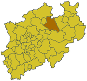
Warendorf ( German: Warendorf ) is a district in Germany . The center of the district is the city of Warendorf . The area is part of North Rhine-Westphalia . Subordinate to the administrative district of Münster . It covers an area of 1318 km². The population is 278.7 thousand people. (2010). The population density is 212 people / km². The official area code is 05 5 70.
| Warendorf | |||
|---|---|---|---|
| Warendorf | |||
| |||
| A country | Germany | ||
| Land | North Rhine-Westphalia | ||
| Administrative District | Munster | ||
| Administrative center | Warendorf | ||
| Landrath | Olaf Gerikke ( CDU ) | ||
| Based | |||
| Square | 1317.71 km² | ||
| Official language | Deutsch | ||
| Population | 278 725 people | ||
| Population density | 212 people / km² | ||
| Official code | 05 5 70 | ||
| Car code | WAF | ||
| Site | www.kreis-warendorf.de | ||
| Address | Waldenburger straße 2 48231 Warendorf | ||
 | |||


The area is divided into 13 communities.
Cities and Communities
- Alain (53 578)
- Warendorf (38,208)
- Beckum (36,669)
- Elde (29 374)
- Ennigerlo (19,889)
- Telgte (19 108)
- Drensteinfurth (15 358)
- Sassenberg (14,290)
- Sendenhorst (13,282)
- Wadersloh (12,624)
- Ostbevern (10,586)
- Eferswinkel (9454)
- Belen (6305)
(June 30, 2010)