Breakage - a river in Russia , flows along the Perm Territory . It falls to the right into Suzva [2] . The river is 51 km long and has a catchment area of 380 km².
| Breakage | |
|---|---|
| Characteristic | |
| Length | 51 km |
| Swimming pool | 380 km² |
| Watercourse | |
| Source | |
| • Height | above 147.0 m |
| • Coordinates | |
| Mouth | Suzva |
| • Height | 87.5 m |
| • Coordinates | |
| Location | |
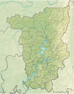
| Water system | Suzva → Kama → Volga → Caspian Sea |
| A country |
|
| Region | Perm region |
| Areas | Karagaysky district , Nytvensky district , Krasnokamsky district |
| HWR code | |
The source of the river on the Verkhnekamsk Upland near the village of Malaya Kazan is 10 km northwest of the village of Grigoryevskoye . The source of the river is located on the watershed with the Obva basin. The source and headwaters are in the Karagaysky district , then the river flows through the Nytvensky district , and the lower reaches are located in the Krasnokamsky district .
The general direction of the current is southeast. The river flows through the villages of Kartishi, Platonovo, Zhulany, Reuna, Palkino, Arkhipovo, Yakunino, Posnata, Galki, Lyagushino, Chisly, Zimonkino, Savinyata. In the village of Numbers on the river is a dam and a dam. Near the mouth it is divided into two arms, the main one flows into Suzva from the right, the second one flows into Suzvensky Bay near the village of Verkhnee Gulyaevo [2] . The width of the river before separation is 12 meters, the depth is 1.0, the flow velocity is 0.3 m / s [3] .
Tributaries (km from the mouth)
- Ryazanovka river (lv)
- 8.4 km: Dyuldina river (lv)
- Chislovka River (pr)
- Talitsa river (pr)
- Beryozovka river (lv)
- Makhlyazhikha river (pr)
- Ryabinovka river (pr)
- 35 km: Severnaya river (lv)
- Olkhovka river (lv)
- Korolevka river (pr)
Water registry data
According to the state water register of Russia, it belongs to the Kama basin district , the water sector of the Kama river from the Kama hydroelectric complex to the Votkinsk hydroelectric complex , the river sub-basin - the Kama tributary basins to the confluence of the White. The river basin of the river is Kama [4] .
The code of the object in the state water registry is 10010101012111100014172 [4] .
Notes
- ↑ Surface Water Resources of the USSR: Hydrological Understanding. T. 11. The Middle Urals and the Urals. Vol. 1. Kama / ed. V.V. Nikolaenko. - L .: Gidrometeoizdat, 1966 .-- 324 p.
- ↑ 1 2 Map sheet O-40-064-C - FSUE GOSGISCENTER
- ↑ Map sheet O-40-64 Krasnokamsk . Scale: 1: 100,000. 1979 edition
- ↑ 1 2 State Water Register . Damage . textual.ru . Ministry of Natural Resources of Russia (March 29, 2009). Date of treatment December 20, 2018. Archived March 29, 2009.