Graves County ( eng. Graves County ) is located in Kentucky , USA . Officially founded in 1824 . As of 2010 , the population was 37,121 people.
| district | |
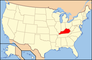
| Graves County, Kentucky | |
|---|---|
| Graves County, Kentucky | |
| A country | USA |
| Enters into | Kentucky |
| Adm Centre | |
| History and geography | |
| Date of education | 1824 |
| Square | 1,442.631 km² |
| Timezone | UTC-6 / -5 |
| The largest city | |
| Population | |
| Population | 37 121 people ( 2010 ) |
| Density | 25,869 people / km² |
| Official language | English |
| Official site | |
 | |
 | |
Content
Geography
According to the United States Census Bureau , the total area of the county is 1,442.631 km 2 , of which 1,429.681 km 2 is land and 12,950 km 2 or 0.900% is water.
Neighboring counties
Population
According to the 2000 census [1] , 37,028 residents live in the district as part of 14,841 households and 10,566 families . The population density is 26.00 people per km 2 . There are 16,340 residential buildings in the district, with a building density of about 11.00 buildings per km 2 . The racial composition of the population: whites - 92.73%, African Americans - 4.44%, Native Americans ( Indians ) - 0.20%, Asians - 0.20%, Hawaiians - 0.01%, representatives of other races - 1.30 %, representatives of two or more races - 1.11%. Hispanic people accounted for 2.40% of the population, regardless of race .
31.50% of the total number of households are children under the age of 18, 57.90% of households are married couples living together, 10.00% of households are single women without a spouse, 28.80% of households households are not related to families , 26.20% of households consist of one person, 12.70% of households consist of elderly (65 years and older) living alone. The average household size is 2.44 people, and the average family size is 2.92 people.
The age structure of the district: 24.50% younger than 18 years old, 8.30% from 18 to 24, 27.30% from 25 to 44, 23.80% from 45 to 64 and 23.80% from 65 and older. The average age of a resident of the district is 38 years. For every 100 females there are 95.00 males . For every 100 females over 18, there are 91.50 males .
The average income per household in the district was 30,874 USD , per family - 38,054 USD . The average salary of a man was 32,016 USD against 20,177 USD for a woman . The per capita income was 16,834 USD . About 13.10% of families and 16.40% of the total population were below the poverty line , including 21.70% of young people (those who were under 18) and 14.10% of those who were over 65 .
Notes
- ↑ United States Census Bureau data for Graves County (Kentucky) (English) (not available link) . The date of circulation is November 16, 2009. Archived April 11, 2012.
Links
- Graves, Kentucky County Government Official Website
- National Association of the United States
- Graves county schools
- Graves County, Kentucky Chamber of Commerce (Inaccessible link) . Archived December 24, 2005.
- Graves County Cluster of United Methodist Churches (not available link) . Archived September 16, 2009.
- Mayfield Graves County Airport