Devon Island [1] ( Eng. Devon Island ) - a large uninhabited island in the Canadian Arctic Archipelago , administratively belongs to the Kikiktani region of Nunavut province.
| Devonian | |
|---|---|
| English Devon island | |
 | |
| Specifications | |
| Square | 55,247 km² |
| Highest point | 1921 m |
| Population | 0 people (2019) |
| Location | |
| Water area | Arctic Ocean |
| A country |
|
| Territory | Nunavut |

Content
Geography
Devon Island is part of the Queen Elizabeth Islands . The largest uninhabited island on the globe, the area is 55,247 km², the length of the coastline is 3,589 km [2] . It ranks 27th in terms of area in the world and 6th in Canada . The shape resembles the Latin letter L (or an old Dutch wooden shoe ). The length of the island from west to east is 503 km, from south to north - 289 km.
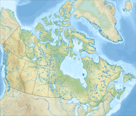
The island is located north of the Lancaster Strait, which separates it from Baffin Island . In the west, the Wellington Strait separates Devon from Cornwallis , the Penny Strait from the Bathurst Island, in the north-west the Cardigan Strait from the small North Kent Island, in the north the Jones Strait - from Ellesmere Island , in the northeast - the Lady Anne Strait from Koberg Island, from the east, the island is washed by the Baffin Sea .
Devon Island has three extensive geological zones. The eastern zone occupies the eastern tip of the island from the line running from Cape Sparbo on the northern coast to Croker Bay on the southern coast, covers part of the Canadian Shield and is almost completely covered with a huge ice cap covering 12,000 km² and containing approximately 3,980 km³ of ice, with a maximum thickness of 880 meters . Under the layer of ice is the highest peak of the island (1921 meters above sea level). The central zone is located between Crocker Bay and the line laid south-west from the Viks fjord in the north to Dragleybeck Bay on the south coast, the terrain consists of a raised plateau at an altitude of 300-400 meters. This zone is part of the Lancaster Plateau (parts of this plateau are also located on the Baffin Island and Ellesmere Islands, as well as on the Botia Peninsula of mainland Canada). The northwestern zone includes the rest of the island including the Grinnell Peninsula. The territory of this zone is dominated by hilly terrain [3] .
It is complicated by the Precambrian gneiss and Paleozoic aleurites and shales . Because of the relatively high altitudes above sea level and its location at high latitudes, only a small population of musk oxen , small birds and mammals lives on the island. The fauna of the island is concentrated on the plains of Truelove ( Truelove Lowland ), where there is a more favorable microclimate and relatively more abundant arctic vegetation. The temperature in a short summer (from 40 to 55 days) rarely rises above 10 ° C, and in winter it can fall below −50 ° C. In the conditions of polar tundra on the island of Devon little rain falls.
The island is located impact crater Hoton ( eng. Haughton ), formed about 39 million years ago with a meteorite falling about 2 km in diameter. Upon impact, a crater with a diameter of about 24 km was formed, which was filled with water and existed in the form of a lake for several million years.
Radiolocation data showed that under the ice cap at a depth of 550–750 m there are two lakes of 5 and 8 km². Perhaps the water in the lakes is 4-5 times more salty than sea water [4] .
History
The island was discovered in 1616 by the British expedition of William Baffin and R. Baylot during the search for the Northwest Passage from the Atlantic to the Pacific Ocean . In 1819, it was named after Devon County in Great Britain by the famous English navigator William Parry [5] .
In August 1924 , a station was opened in Dundas Harbor ( Eng. Dundas Harbor , ) as part of whaling of other countries in Canada.
In 1934 , the fall in furs prices and some other economic reasons forced 53 Inuit families from Baffin Earth to relocate to Devon. However, due to much more severe climatic conditions, the Inuit left the island in 1936 . A border garrison opened in Dundas Harbor in the 1940s , but was finally closed in 1951 .
In July 2004, five scientists and two journalists temporarily settled on Devon who modeled the living and working conditions on the planet Mars . In addition, at Devon, NASA is conducting a program to study geology , hydrology , botany, and microbiology .
Today, in Dundas Harbor, only the remains of several buildings have been preserved.
Island surface pattern
Satellite photo of Devon and neighboring islands
Links
Notes
- ↑ A.P. Gorkin . Geography. - M .: Rosmen-Press, 2006. - 624 p. - (Modern illustrated encyclopedia). - 10 000 copies - ISBN 5-353-02443-5 .
- ↑ Atlas of Canada. List of Islands (not available link) . The date of circulation is January 26, 2011. Archived January 22, 2013.
- ↑ The Island encyclopedia. Devon island
- ↑ In the Arctic, discovered the world's first salt ice lakes
- ↑ Encyclopedias on Academic. Dictionary of modern geographic names