Bolshaya Surva - a river in Russia , flows in the Karagai district of the Perm Territory . The mouth of the river is 12 km along the left bank of the Surva River, Big Surva forms it merging with Malaya Surva . The length of the river is 21 km [1] .
| Big Surva | |
|---|---|
| Characteristic | |
| Length | 21 km |
| Watercourse | |
| Source | |
| • Height | above 156.8 m |
| • Coordinates | |
| Mouth | Surva |
| • Location | 12 km on the left bank |
| • Height | below 139.6 m |
| • Coordinates | |
| Location | |
| Water system | Surva → Obva → Kama → Volga → Caspian Sea |
| A country |
|
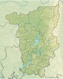
| Region | Perm region |
| Area | Karagaysky district |
The source of the river in the forests on the Verkhnekamsk Upland near the border of the Kudymkar district , 15 km south-west of the village of Nerdva [2] . The river flows to the south-east, the tracts of Tishino, Gavyata [3] , the villages of Vikulyata, Mishino, Kuzdera, Torgushino, Bragino [4] flow. Tributaries - Sensation, Rise (left) [3] . It is the right component of Surva.
Notes
- ↑ The Water Register of Russia considers the Big Surva to be the beginning of Surva and gives the total length of 33 km for Surva
- ↑ Map sheet O-40-39 Nerdva . Scale: 1: 100,000. Status of the terrain for 1982. 1988 edition
- ↑ 1 2 Map sheet O-40-50 Obvinsk . Scale: 1: 100,000. 1989 edition.
- ↑ Map sheet O-40-51 Rozhdestvensk . Scale: 1: 100,000. 1966 edition