Melville Island is an island in Canada .
| Melville | |
|---|---|
| English Melville island | |
 | |
| Characteristics | |
| Area | 42,149 km² |
| Highest point | 776 m |
| Population | 0 pax (2012) |
| Location | |
| Water area | Arctic Ocean |
| A country |
|
| Provinces | Nunavut , Northwest Territories |
Content
- 1 Geography
- 2 History
- 3 See also
- 4 notes
Geography
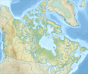
It is part of the Canadian Arctic Archipelago , Queen Elizabeth Islands and the Parry Archipelago . Administratively divided between Nunavut ( Kikiktani region ) and the Northwest Territories . Covering an area of 42,149 km², the island is ranked 33rd in terms of area in the world and 8th in Canada . The largest island of the Parry Archipelago . The coastline is 3107 km [1] . Melville Island is located 36 km west of the islands of Alexander , Massey , Wannier , included in the coastal group of Bathurst Island (through the Bayam Martin), 27 km west of the island of Bayam Martin (through the Bayam), 23 km to southeast of Prince Patrick Island (across the Fitz William Strait) and 26 km south of Emerald Island. The 122 km wide Wycometz-Melville Strait separates Melville from the islands of Victoria and Stefansson in the south, while the 102 km wide McClure Strait separates it from Banks Island in the southwest, and the Kellett Strait separates from Eglinton Island in the west.
Melville Island has a very irregular shape, formed by several large peninsulas and bays. From the north side, a wide Gulf of Hekla and Graper wedges inland, and from the south-west is the narrow Gulf of Liddon. These bays give the island its characteristic shape and create three peninsulas: the Sabin peninsula in the northeast, the Dundas peninsula in the southwest and the highly serrated peninsula in the northwest. The maximum length of the island from east to west is 340 km, from north to south - 212 km.
The terrain on the island can be divided into three broad topographic zones: the southwestern plateau , the central highlands and the lowland region in the northeast [2] . The highest point of the island is Mount Blue Hills in the western part of the island, 776 meters above sea level. Uninhabited. In the vicinity of the island, natural gas deposits are expected.
The average summer temperature here usually does not exceed plus 5 degrees, and this island is considered one of the coldest places in subarctic North America .
History
The island was discovered by William Parry in 1819 . Named after Robert Dundas, 2nd Viscount Melville.
See also
Melville Island Wolf
Notes
- ↑ Atlas of Canada. List of Islands (link not available) . Date of treatment January 6, 2011. Archived January 22, 2013.
- ↑ Oceandots.com. Melville island