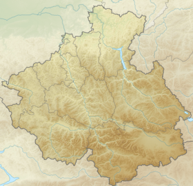
Uch-Enmek is a specially protected natural area of the Altai Republic . The Uch-Enmek Nature Park was established by Decree of the Government of the Altai Republic No. 109 of April 23, 2001 [1] .
| Uch Enmek Natural Park | |
|---|---|
| basic information | |
| Square | 60.6 ha |
| Average height | 1,500 m |
| Established | April 23, 2001 |
| Location | |
| A country |
|
| The subject of the Russian Federation | Altai Republic |
| Nearest town | Ongudai |
uchenmek.ru | |


Content
Geographical position
“Uch-Enmek Natural Park is located in the physical and geographical province of Central Altai in the Ongudai administrative region in the Karakol River basin” [1] .
Of the total area of the natural park 60551 ha:
- 810 ha are reserved for the conservation area (A); any activity is prohibited in it;
- 4777 ha - under specially protected area (B); any economic activity is prohibited, except for excursion routes with the obligatory accompaniment of a guide;
- 54964 hectares - under the recreation zone (B).
Mount Uch-Enmek (2792m), which gave the name to the park, is a sacred mountain for Altai people. "Uch" - three, "Enmek" - the head (crown, crown), Mount Uch-Enmek - has three peaks.
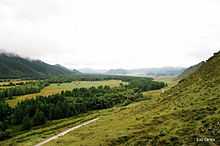
The territory of the park is located on the northern slope of the Terektinsky ridge . The relief formation was greatly influenced by past glaciation. The impact of ancient glaciers on the axial sections of the main ranges led to the formation of peaked peaks, cup-shaped valleys with many lakes. There are no large lakes in the park; all available lakes are located in glacial valleys and karst craters and are most often of glacial , rarely tectonic, origin. In the highlands, glacial lakes form a multi-stage cascade. The difference in elevation is from 2800 m above sea level to 900 m in the valley of the Ursul River. The highest peak in the park - Mount Uch-Enmek - reaches a height of 2821 m. Thus, the relief forms characteristic of various altitudinal zones of Central Altai are quite fully represented in the park.
Historical monuments are located on the so-called. transformed territories: river valleys, mountain slopes, where agricultural land is also located - arable land, pastures, settlements of indigenous Altai. The undisturbed territories of the natural park include the alpine zone - Mount Uch-Enmek and the adjacent areas - alpine landscapes (glacial-nival and tundra).
Attractions
On the territory of the Uch-Enmek park, traces of ancient cultures have survived - Afanasyevskaya (3 thousand years BC), Karakol (1.5 years BC), Scythian (VIII-IV centuries BC. ), Turkic (VI – VIII centuries A.D.). About five thousand historical and cultural monuments - stone steles, mounds, balbals , cave paintings , which were once unique altars - are located in the tracts of Sooru and Bashadar and not far from the village of Tuekta .
In the upper reaches of the Arygem river on the northern slopes of the central part of the Terektinsky ridge, the Arygem lake, sacred to the indigenous population, is located (Arukem - from the alt. "Clear lake"). It is located about 15 km from the village of Kulada towards the Terektinsky ridge. The picturesque mountain lake with a diameter of about 600 m, is located at an altitude of 1300-1400 m. From the lake opens a panorama of the Terektinsky ridge and one of its peaks - Uch-Enmek.
The burial mound "Ust-Karakol" is located opposite the confluence of the Karakol River in Ursul . It is an object of cultural heritage [3] .
Sculpture "Karakolkoye" is located at the entrance to the village of Kulada [4] ..
Paleolithic site of Ust-Karakol [5] .
See also
- Afanasyev culture
- Karakol culture
- Scythians
- Turki
Notes
- ↑ 1 2 Collection of Legislation of the Altai Republic, Issues 32-34 - P. 201
- ↑ 0210032000 | sculpture "Karakol" . Archive of cultural heritage. Date of treatment April 23, 2019.
- ↑ Monuments of history and culture of the peoples of the Russian Federation - Kurgan burial ground “Ust-Karakol” (Inaccessible link) . Date of treatment November 24, 2014. Archived November 29, 2014.
- ↑ Historical and Cultural Monuments of the Peoples of the Russian Federation - “Karakolsky” (Unavailable link) Date of treatment November 24, 2014. Archived November 29, 2014.
- ↑ Derevyanko A.P. , Shunkov M.V. Development of Paleolithic traditions in Altai and the problem of the formation of a person of a modern kind. Continuity and transformations in ancient and medieval societies according to archaeological anthropological data // Traditions and Innovations in History and Culture, 2015
Literature
- Museum World. Issues 245–256 - Publishing House of the JV Panas, 2008 - P. 29.