Yalankul [1] [3] ( Yalankul [5] [6] , obsolete. Yalan-Kul [2] ; Bashk. Yalankүl [3] ) - the right-bank old woman of the Belaya River in the Birsky district of the Republic of Bashkortostan [1] [3] .
| Lake | |
| Yalankul | |
|---|---|
| head off. Yalankul | |
| Morphometry | |
| Absolute height | 78 [1] m |
| Square | 1.64 [2] km² |
| Average depth | 2.4 [3] m |
| Pool | |
| Flowing river | Source |
| Location | |
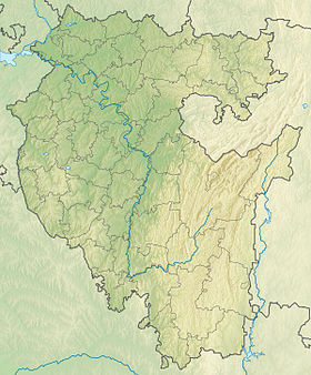
| A country |
|
| The subject of the Russian Federation | Bashkortostan |
| Area | Birsky district |
| Identifiers | |
| HWR : | |

Name Origin
The limononym comes from the Bashkir words Yalan - “steppe, field” and Kal - “lake” [6] [7] .
General characteristics
It is located south of the village of Uguzevo and northwest of the village of Kalinniki [2] [5] .
The area of the lake is 1.64 km², length - 6.5 km, average depth - 2.4 m [3] .
The lake is eutrophic , formed in rocks of the quarters (clay, sands), has an elongated basin, and is fed by precipitation [3] .
Near Yalankul there are lakes Staritsa , Kadrovoye , Svetloye , Emelino , Isen , Dikoe and others. From the southwestern tip of Yalankul there flows the Istok stream, which connects it and the neighboring lakes (Dikoe, Kadrovoye and Staritsa) with Belaya [1] [3] .
Landscapes - meadows, forests, shrubs on marshy dark gray forest, alluvial soils [3] .
On the lake, such birds live as: corolla, tern, mallard, gulls, teal and others [3] .
Notes
- ↑ 1 2 3 4 Card sheet N-40-28-A . Scale: 1: 50,000 . 2001 Edition
- ↑ 1 2 3 State Water Register . Yalan-Kul . textual.ru . Ministry of Natural Resources of Russia (March 29, 2009). Date of treatment December 20, 2018. Archived March 29, 2009.
- ↑ 1 2 3 4 5 6 7 8 9 10 A. M. Gareev. Yalankul // Bashkir Encyclopedia / main ed. M.A. Ilgamov. - Ufa: GAUN “ Bashkir Encyclopedia ”, 2015—2019. - ISBN 978-5-88185-306-8 .
- ↑ Surface Water Resources of the USSR: Hydrological Understanding. T. 11. The Middle Urals and the Urals. Vol. 1. Kama / ed. V.V. Nikolaenko. - L .: Gidrometeoizdat, 1966 .-- 324 p.
- ↑ 1 2 Data obtained using the Public Cadastral Map on the official website of Rosreestr .
- ↑ 1 2 Tuguzbaeva O. V. The lexical-semantic and structural-grammatical aspects of toponymy (based on the material of toponyms of Birsk and Birsky district) . bashedu.ru. - Portal of Bashkir State University. Date of treatment June 9, 2016.
- ↑ Instruction for the Russian transfer of geographical names of the Bashkir Autonomous Soviet Socialist Republic / Comp .: G. I. Donidze ; Ed .: 3. G. Uraksin . - M .: Nauka , 1983 .-- 39 p. - 290 copies.