Havel ( German Havel [ˈhaːfl̩] ) - a river in the north-east of Germany , the right tributary of the Elbe .
| Hafel | |
|---|---|
| him. Havel | |
 Havel in Berlin Havel in Berlin | |
| Characteristic | |
| Length | 333.7 km |
| Swimming pool | 23,858 km² |
| Water consumption | 88.8 m³ / s |
| Watercourse | |
| Source | Woblitsze |
| • Location | Mecklenburg-Vorpommern |
| • Coordinates | |
| Mouth | Elba |
| • Coordinates | |
| Location | |
| Water system | Elba → North Sea |
| A country |
|
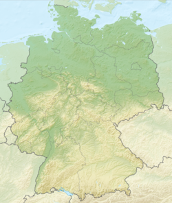
| Regions | Mecklenburg-Vorpommern , Brandenburg , Berlin , Saxony-Anhalt |
The length of the river is 333.7 km, the catchment area is 23 858 km² [1] . The average water flow rate is about 88.8 m³ / s [2] . The main tributary is the Spree .
For most of its length, Havel is navigable and is an important transport route between east and west of Germany. From source to mouth on the river, there are cities: Oranienburg , Berlin , Potsdam , Brandenburg an der Havel [3] , Rathenov , Havelberg .
In the Middle Ages, the river was called Gavola ( N.-puddle. and v. puddles. Habola , polish. Hawela , Czech Havola ), its shores were inhabited by the Slavic tribe of the Havelians .
Content
- 1 River
- 2 Navigation
- 3 Photo Gallery
- 4 See also
- 5 notes
- 6 References
River
The source of the river is in the Mecklenburg Lake District , between Lake Muritz and the city of Neubrandenburg . There is no noticeable source, but the river originates in lakes near Ankershagen . From there, the river first flows south, at Potsdam turns west, and, ultimately, flows into the Elbe , which in turn flows into the North Sea . In its upper reaches, as well as between Berlin and Brandenburg an der Havel , the river forms several lakes.
The region around middle Havel is called Havelland . It consists of sandy hills and lowland marshes.
Navigation
The Havel River is navigable from the Mecklenburg Lake District to the confluence of the Elbe. In terms of navigation, the Havel can be divided into four parts with slightly different features and controls:
- from the start of shipping to Liebenwalde
- from Liebenwalde to Spandau
- from Spandau to Plaue
- from plaue to havelberg
Photo Gallery
See also
- Elbogenense
- Elbe-Havel Group
Notes
- ↑ Gewaessersteckbrief-Elbe, Plan Hochwasservorsorge Dresden, 2010 (German) . dresden.de . Date of treatment February 25, 2012. Archived June 4, 2012.
- ↑ Axel Bronstert, Sibylle Itzerott. Bewirtschaftungsmöglichkeiten im Einzugsgebiet der Havel . - 2006 .-- S. 20.
- ↑ Brandenburg, city // Brockhaus and Efron Encyclopedic Dictionary : in 86 volumes (82 volumes and 4 additional). - SPb. , 1890-1907.
Links
- Havel - an article from the Great Soviet Encyclopedia .
- Die untere Havel (German)
- Untere Havel-Wasserstraße (German)
- Renaturierung der Unteren Havelniederung (German)
- Kanurundtour Obere Havel - Müritz (German)
- Touristische Infos zur Havel (German)