Calhoun County is located in the United States , West Virginia . Officially formed in 1856, it got its name in honor of the American political and statesman John Calhoun . As of 2012 , the population was 7,607.
| district | |
| Calhoun County, West Virginia | |
|---|---|
| Calhoun County, West Virginia | |
| A country | USA |
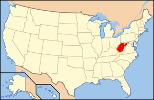
| Included in | West Virginia |
| Adm. center | Grantsville, West Virginia |
| History and geography | |
| Date of formation | 1856 |
| Area | 728 km² |
| Timezone | UTC-5 / -4 |
| The largest city | Grantsville, West Virginia |
| Population | |
| Population | 7 607 people ( 2012 ) |
| Density | 10 people / km² |
| Official site | |
 | |
 | |
Content
- 1 Geography
- 1.1 Neighboring Counties
- 2 population
- 3 Notes
- 4 References
Geography
According to the United States Census Bureau , the county’s total area is 728 km ², of which 723 km ² are land and 4.0 km ² or 0.5% are water bodies.
Neighboring Counties
- Ritchie (West Virginia) - North
- Gilmer (West Virginia) - east
- Braxton (West Virginia) - Southeast
- Clay (West Virginia) - South
- Roan (West Virginia) - West
- Wirt (West Virginia) - Northwest
Population
According to the 2000 census [1] , 7,582 residents of 3,071 households and 2,201 families live in the okrug. The population density is 10 people per km ². In the district there are 3,848 residential buildings, with a building density of 5 buildings per km ². Racial composition of the population: white - 98.91%, African - Americans - 0.11%, Native Americans ( Indians ) - 0.30%, Asians - 0.11%, Hawaiians - 0.01%, representatives of other races - 0.13 %, representatives of two or more races - 0.44%. Hispanics made up 0.55% of the population, regardless of race .
Out of the total number of households , 28.90% are children under the age of 18 years, 57.00% of households are married couples living together, 10.30% of households are single women without a spouse, 28.30% of households households are not related to families , 24.90% of households consist of one person, 12.30% of households consist of elderly people (65 years and older) living alone. The average household size is 2.46 people and the average family size is 2.91 people.
The age structure of the district: 22.40% under the age of 18, 8.00% from 18 to 24, 25.90% from 25 to 44, 27.10% from 45 to 64 and 16.70% from 65 and older. The average age of a resident of the district is 41 years. For every 100 females there are 99.70 males . For every 100 females over 18 years of age, there are 98.30 males .
The average household income in the district was 21,578 USD , per family - 26,701 USD . The average male earnings were $ 25,609 versus $ 14,304 for a woman . The per capita income was 11,491 USD . About 19.10% of families and 25.10% of the total population were below the poverty line , including 29.40% of youth (those who were not yet 18 years old) and 24.90% of those who were already over 65 years old.
Notes
- ↑ Data from the US Census Bureau for Calhoun County (West Virginia ) . Treatment date November 16, 2009. Archived April 11, 2012.
Links
- Official Website of Calhoun County Government, West Virginia
- Calhoun County Development Corporation, West Virginia
- Geographic Map of Highways in Northern Calhoun County, West Virginia
- Map of Southern Highways in Calhoun County, West Virginia
- Archival and Bibliographic Information for Calhoun County, West Virginia