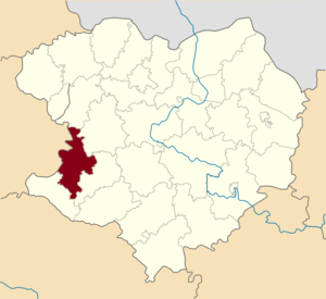
Krasnogradsky district ( Ukrainian: Krasnogradsky district ) is an administrative unit in the south-west of the Kharkov region of Ukraine . The administrative center is the city of regional subordination Krasnograd .
| area | |||||
| Krasnogradsky district | |||||
|---|---|---|---|---|---|
| Krasnogradsky district | |||||
| |||||
| A country | Ukraine | ||||
| Included in | Kharkov region | ||||
| Adm. Centre | Krasnograd | ||||
| History and Geography | |||||
| Date of formation | 1922 year | ||||
| Square | 985 km² | ||||
| Population | |||||
| Population | 44 086 [1] people ( 2017 ) | ||||
| KOATUU | 6323300000 all codes | ||||
 | |||||
 | |||||
![Flag [d]](http://upload.wikimedia.org/wikipedia/commons/thumb/a/a2/UKR_%D0%9A%D1%80%D0%B0%D1%81%D0%BD%D0%BE%D0%B3%D1%80%D0%B0%D0%B4%D1%81%D1%8C%D0%BA%D0%B8%D0%B9_%D1%80%D0%B0%D0%B9%D0%BE%D0%BD_flag.png/160px-UKR_%D0%9A%D1%80%D0%B0%D1%81%D0%BD%D0%BE%D0%B3%D1%80%D0%B0%D0%B4%D1%81%D1%8C%D0%BA%D0%B8%D0%B9_%D1%80%D0%B0%D0%B9%D0%BE%D0%BD_flag.png)
![Coat of arms [d]](http://upload.wikimedia.org/wikipedia/commons/thumb/f/f8/Vollwappen_Rajon_Krasnohrad.png/90px-Vollwappen_Rajon_Krasnohrad.png)
Content
Geography
Area - 985 km². The district borders on Valkovsky , Novovodolazhsky , Kegichevsky and Zachepilovsky districts of the Kharkov region , as well as the Karlovsky district of the Poltava region .
The area is located in the forest-steppe zone. The climate is temperate continental. The average annual temperatures - summer - +19.7 ° C, winter - 5.1 ° C. The average rainfall is 563 mm. Typical landscapes are the steppe , small forests. The soil is fertile - mainly black soil .
5 rivers flow through the district. The main river is Berestovaya .
Natural resources (minerals): forming clays, clays for clay solutions, sandstones, building and glass sands, clays for brick making, natural gas, reserves of rock salt and potassium-magnesium salts (bischofite).
History
The district was founded in 1922 .
Demographics
The population of the district is 48 thousand people. Of these, urban residents - 21.8 thousand people, rural - 26.2 thousand people. The population density is 50 people per 1 sq. Km. km
Administrative device
The area includes:
|
|
Local tips
Krasnograd City Council | Natalinsky village council |
Settlements
with. Alexandrovka | with. Kamenka | with. Deer |
Eliminated Settlements
with. Katerinovka | pos. Leninsky (Natalinsky village council) | with. Novomikhaylovka |
Economics
Krasnogradsky district is an agricultural region, which has 29 agricultural enterprises of various patterns of ownership. It specializes in the cultivation of grain and industrial crops, the cultivation of cattle in the meat and dairy direction, pig breeding, poultry farming. The area of agricultural land (for all producers, including subsidiary farms) - 79.1 thousand hectares, of which: arable land - 65.5 thousand hectares; pastures - 7.7 thousand hectares.
Transport
Highways Kharkiv - Simferopol , Krasnograd - Poltava pass through the district. From the railway junction of the station Krasnograd (until 1964 - the station Konstantinograd), lines extended to Dnepropetrovsk, Poltava, Kharkov and Lozova. Operational length: railways - 47.9 km; roads of national, regional and local significance - 349.5 km.
Culture
Attractions
Bibliography
Notes
- ↑ [1] // Head of statistics department in Kharkiv region