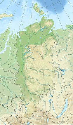
Garevka (outdated. Gorevka [2] ) is a river in the Yenisei district of the Krasnoyarsk Territory , a right tributary of the Yenisei .
| Garyovka | |
|---|---|
| Characteristic | |
| Length | 99 km |
| Pool | 900 km² |
| Watercourse | |
| Source | |
| • Location | Yenisei Ridge |
| • Height | 480 m |
| • Coordinates | |
| Mouth | Yenisei |
| • Height | 50 m |
| • Coordinates | |
| Location | |
| Water system | Yenisei → Kara Sea |
| A country |
|
| Region | Krasnoyarsk region |
| Area | Yenisei district |
| HWR Code | |
The length of the river is 99 km, the catchment area is 900 km² [2] . The source of Garevka is located in the mountains of the Yenisei Ridge [3] , at an altitude of over 480 m [4] , the mountain river is full of rapids [5] , it flows, often changing direction, mainly to the south-west. It falls into the Yenisei at an altitude of 50 m above sea level, 1833 km from the mouth.
Tributaries
- Polo (Left Pola) - 30 km on the right bank, length 17 km [6] ;
- Black - 31 km on the left bank, length 17 km [7] ;
- river without a name (on the map - Khariusovka [5] ) - 37 km on the left bank, length 17 km [8] ;
- Malaya Garevka - 72 km on the right bank, 19 km long [9] .
In addition, one more tributary without a name 10 km long is recorded in the state water register, flowing into the right 46 kilometers along the right bank [10] , and two flowing into the lower reaches of the river Stony Left and Lesnaya 1 - right [ 11] .
According to the state water register of Russia, it belongs to the Yenisei Basin District [2] . The object code is 17010400112116100028756 [2] .
Notes
- ↑ Surface water resources of the USSR: Hydrological knowledge. T. 16. Angaro-Yenisei district. Issue 1. Yenisei / ed. G.S. Karabaev. - L .: Gidrometeoizdat, 1967. - 823 p.
- ↑ 1 2 3 4 State Water Register . Garevka . textual.ru . Ministry of Environment of Russia (March 29, 2009). The appeal date was December 20, 2018. Archived March 29, 2009.
- ↑ Map sheet P-46-B, G.
- ↑ Map Sheet P-46-XXXI, XXXXII .
- ↑ 1 2 Map Sheet O-46-3 mouth Gusyanka . Scale: 1: 100,000. State of the area in 1966. 1977 edition
- ↑ State Water Register . Hollow . textual.ru . Ministry of Environment of Russia (March 29, 2009). The appeal date was December 20, 2018. Archived March 29, 2009.
- ↑ State Water Register . Black . textual.ru . Ministry of Environment of Russia (March 29, 2009). The appeal date was December 20, 2018. Archived March 29, 2009.
- ↑ State Water Register . Untitled River . textual.ru . Ministry of Environment of Russia (March 29, 2009). The appeal date was December 20, 2018. Archived March 29, 2009.
- ↑ State Water Register . Small Garevka . textual.ru . Ministry of Environment of Russia (March 29, 2009). The appeal date was December 20, 2018. Archived March 29, 2009.
- ↑ State Water Register . Untitled River . textual.ru . Ministry of Environment of Russia (March 29, 2009). The appeal date was December 20, 2018. Archived March 29, 2009.
- ↑ Sheet Card O-46-2 Nizhneshadrino . Scale: 1: 100,000. State of the area in 1966. 1977 edition
