This is a river in Russia , flows in the Kosinsky district of the Perm Territory . The mouth of the river is 86 km on the left bank of the Kos River. The river is 38 km long.
| This | |
|---|---|
| Characteristic | |
| Length | 38 km |
| Watercourse | |
| Source | |
| • Height | above 173.0 m |
| • Coordinates | |
| Mouth | Scythe |
| • Location | 86 km on the left bank |
| • Height | 127.8 m |
| • Coordinates | |
| Location | |
| Water system | Kosa → Kama → Volga → Caspian Sea |
| A country |
|
| Region | Perm region |
| Area | Kosinsky district |
| HWR code | |
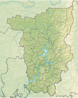
The source of the river on the Verkhnekamsk Upland is 22 km southeast of the village of Puksib . The source lies on the watershed of the Kosa and Urolka basins ; next to the source of these, the Vyrvazh River, a tributary of the Urolka, originates. In the upper stream flows to the southwest, after the confluence Kyuju turns to the northwest. In the upper reaches near the river, the villages of Grishkino and Denino, the lower reaches pass through an uninhabited forest. It flows into the Spit opposite the village of Puxib .
Content
Tributaries (km from the mouth)
- 7.2 km: Sedzsia River (ave)
- Pipuashor stream (pr)
- 22 km: Kiju river (Kadzhiju [2] , lv)
- Pavzhinshor creek (lv)
Water registry data
According to the state water register of Russia, it belongs to the Kama basin district , the Kama river water sector from the source to the water gauge near the village of Bondyug , the river sub-basin - the Kama tributary basins to the confluence of the White. The river basin of the river is Kama [2] .
According to the geographic information system of water management zoning of the territory of the Russian Federation, prepared by the Federal Agency for Water Resources [2] :
- The code of the water body in the state water registry is 1001010011221111100002772
- The code for hydrological knowledge (GI) is 111100277
- Pool code - 10.01.01.001
- GI Volume Number - 11
- GI Issue - 1
Notes
- ↑ Surface Water Resources of the USSR: Hydrological Understanding. T. 11. The Middle Urals and the Urals. Vol. 1. Kama / ed. V.V. Nikolaenko. - L .: Gidrometeoizdat, 1966 .-- 324 p.
- ↑ 1 2 3 State Water Register . This (brook Pavzhinshor) . textual.ru . Ministry of Natural Resources of Russia (March 29, 2009). Date of treatment December 20, 2018. Archived March 29, 2009.