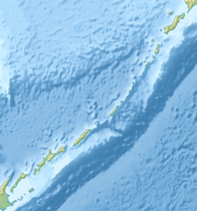
Storozhevoy ( Japanese 萌 茂 尻 島 moemosiri-shima ) is an island in the Soviet Strait of the Pacific Ocean as part of the Lesser Kuril Ridge . It is located at the southeastern end of the Dangerous bank and is the largest of the islands and drying rocks [2] located on this bank [3] . Height 11.8 m. The island is flat, with steep banks. Covered in grass. The Japanese name of the island of Moemosiri, in turn, goes back to the Ainu moi -mo-siri ("island of quiet waves"). In Japanese historiography, at different times, other names also existed: Moromoshir (Matsumai), Moiosiri (Ezo), Montmosiri , My Kojima (scientific journals). It has a triangular shape with sides of 500, 600 and 300 m [4] . The sea around the island is shallow (2–8 m), rich in biological resources ( cod , kelp ).
| Watchdog | |
|---|---|
| jap. 萌 茂 尻 島 | |
 Watchdog Island on the satellite image of the ISS | |
| Specifications | |
| Square | 0.07 km² |
| Highest point | 11.8 m |
| Population | 0 pax |
| Location | |
| Archipelago | Small Kuril ridge , Khabomai |
| A country |
|

According to the federal structure of Russia, it is part of the Sakhalin region as part of the South Kuril region as part of the administrative and territorial structure of the region and as part of the South Kuril city district as part of the municipal structure in the region . The island is disputed by Japan , which includes it in its sub-prefecture of Nemuro , Hokkaido [5] [6] [7] . From the point of view of Japan, it belongs to the group of Habomai islands (Flat Islands), which are considered to be the continuation of the coastline of the Japanese island of Hokkaido and are not considered as part of the Kuril Islands [8] .
At the peak of Japanese rule (in the 1930s) attempts were made to populate the island with fishermen: for example, on May 3, 1933, there is a record of two dead under a snow drift [9] . The island was included in the USSR following the Second World War, along with a number of other Japanese territories in 1945 .
Notes
- ↑ This geographical feature is located in the waters of one of the islands that are the subject of a territorial dispute between Russia , the ruling of these islands, and Japan . In accordance with the Constitution of the Russian Federation, the island is part of the territory of the Russian Federation , according to the administrative-territorial division of Japan - it is part of the Nemuro District of Hokkaido Prefecture in Japan .
- ↑ A drying rock appears above the water at low tide.
- ↑ <iframe src = " https://yandex.ru/map-widget/v1/-/CSagFgB " width = "560" height = "400" frameborder = "1" allowfullscreen = "true"> </iframe>
- ↑ Map of Nemuro County (Japanese)
- ↑ Administrative map of Japan (As of April 1, 2014 )
- ↑ Northern Territorial Administration of the General Department of Hokkaido Governorate
- ↑ Northern Territories Issue . // Ministry of Foreign Affairs of Japan (March 1, 2011). - “The Northern Territories consist of four islands located off the northeast coast of the Nemuro Peninsula of Hokkaido. They are: Habomai, Shikotan, Kunashiri and Etorofu. The Northern Territories are not included in the Kurile Islands. ". Date of appeal September 25, 2015.
- ↑ http://eprints.lib.hokudai.ac.jp/dspace/bitstream/2115/18807/1/55_p27-45.pdf