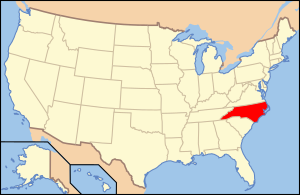
Cleveland is a county in North Carolina , USA . According to the 2010 census, the population was 98,078. [1] The county seat is Shelby .
| district | |||
| Cleveland County | |||
|---|---|---|---|
| Cleveland county | |||
| |||
| A country | USA | ||
| Included in | North Carolina | ||
| Adm. Centre | Shelby | ||
| History and Geography | |||
| Date of formation | 1841 | ||
| Square | 1,215 km² | ||
| Population | |||
| Population | 98 078 people ( 2010 ) | ||
| Density | 80 people / km² | ||
| Official site | |||
 | |||
 | |||

Content
History
The county was formed in 1841 from parts of Lincoln and Rutherford counties. Named after Benjamin Cleveland, Colonel during the US War of Independence , who took part in the Battle of King's Mountain. From 1841 to 1887, the county name was written as "Cleaveland"; the spelling that is currently in use was adopted in 1887. [2]
Geography
According to the US Census Bureau , the county has a total area of 1,214.7 km², of which 1,204.3 km² is land and 10.4 km² water.
Neighboring Counties
- Burke County (North Carolina) - North
- Lincoln County (North Carolina) - Northeast
- Gaston County (North Carolina) - East
- York County (South Carolina) - Southeast
- Cherokee County (North Carolina) - South
- Rutherford County (North Carolina) - West
Roads
|
|
Demographics
| Population census | |||
|---|---|---|---|
| Census year | Us. | % ± | |
| 1850 | 10 396 | ||
| 1860 | 12 348 | 18.8% | |
| 1870 | 12 696 | 2.8% | |
| 1880 | 16 571 | 30.5% | |
| 1890 | 20 394 | 23.1% | |
| 1900 | 25,078 | 23% | |
| 1910 | 29,494 | 17.6% | |
| 1920 | 34,272 | 16.2% | |
| 1930 | 51 914 | 51.5% | |
| 1940 | 58,055 | 11.8% | |
| 1950 | 64 357 | 10.9% | |
| 1960 | 66 048 | 2.6% | |
| 1970 | 72 556 | 9.9% | |
| 1980 | 83,435 | 15% | |
| 1990 | 84 714 | 1.5% | |
| 2000 | 96,287 | 13.7% | |
| 2010 | 98,078 | 1.9% | |
| Current 2012 | 97 474 | -0.6% | |
| 1850-2012 2012 Assessment [1] | |||
According to the 2010 census, there were 98,078 people, 37,046 households, and 27,006 families residing in the district. The average population density was 80 people / km². District racial makeup: 74% White, 21% African American, 0.15% Native American, 0.69% Asian, 0.01% Pacific Islander, 0.68% other race, 0.72% two or more races, and 3 % Spaniards or Hispanics.
Of the 37,046 households, 32.20% had children under the age of 18 years living with them, 55.00% of married couples living together, 13.70% of women living without husbands and 27.10% without families. 23.60% of all households were individuals, of which 9.60% were people 65 years of age or older.
The age structure of the district: 25.20% under the age of 18 years, 8.80% from 18 to 24 years old, 28.80% from 25 to 44 years old, 23.70% from 45 to 64 years old and 13.50% at the age 65 years and older. The average age was 36 years.
The median household income in the county was $ 35,283, and median household income was $ 41,733. Men have an average income of $ 30,882, and women $ 21,995. Per capita income was $ 17.395. About 10.10% of families and 13.30% of the population were below the poverty line, including 17.90% of those under the age of 18 and 14.00% of those aged 65 and over.
Settlements
Cities
- Belwood
- Bowling springs
- Earl
- Grover
- Kings Mountain (part of the city is located in Gaston County)
- Kingstown
- Lattimore
- Londale
- Mursborough
- Patterson springs
- Polkville
- Shelby
- Waco
Villages
- Qasar
- Folston
Townships
The county is divided into eleven townships : River, Boyling Springs, Rippy, King Mountain, Warlick, Shelby, Sandy Run, Polkville, Double Shoals, Nob Creek, Casar.
Notes
- ↑ 1 2 State & County QuickFacts . United States Census Bureau. Date of treatment October 18, 2013.
- ↑ Cleaveland County, North Carolina Archived on July 19, 2012. . Retrieved 2010-12-30.
- ↑ US Decennial Census . Census.gov. Date of treatment October 18, 2013.