Black River in the Leningrad region of Russia . Right tributary Izhora . Length - 23 [2] km. The basin area is 105 [2] km².
| Black | |
|---|---|
| Characteristic | |
| Length | 23 km |
| Pool | 105 km² |
| Watercourse | |
| Source | |
| • Location | D. Semrino |
| • Coordinates | |
| Mouth | Izhora |
| • Height | 33.6 m |
| • Coordinates | |
| River slope | 1.05 m / km |
| Location | |
| Water system | Izhora → Neva → Baltic Sea |
| A country |
|
| Region | Leningrad region |
| HWR Code | |
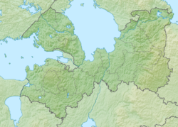
Geography
It originates in the marshland near the Vladimirskaya railway station [3] . Flowing southeast through the forest. In the village of Semrino , two small tributaries flow into the river, after which it turns to the northeast [3] . Further, the river flows in the valley of the glacier formed as a result of a glacier formed the Black River, which is indicated by the fact that a large number of boulder stones are left in the river . In the southwestern outskirts of the village of Annolovo, the Black River flows into the Izhora River.
Water Registry Data
According to the state water register of Russia, it belongs to the Baltic Basin District , the water area of the river is the Neva, the river sub basin of the river Neva and the river basin of Lake Ladoga (without the sub basin Svir and Volkhov, the Russian part of the basins). It belongs to the river basin of the Neva River (including the basins of the rivers Onega and Ladoga) [2] .
Notes
- ↑ Surface water resources of the USSR: Hydrological knowledge. T. 2. Karelia and the North-West / ed. E. N. Tarakanova. - L .: Gidrometeoizdat, 1965. - 700 p.
- ↑ 1 2 3 State Water Register . Black River . textual.ru . Ministry of Environment of Russia (March 29, 2009). The appeal date was December 20, 2018. Archived March 29, 2009.
- ↑ 1 2 Map sheet O-36-13 Gatchina . Scale: 1: 100,000. State of the area in 1981. 1984 edition