Allegheny ( eng. Alleghany County ) is a county in the state of North Carolina , USA . According to the 2010 census, the population was 11,155 people. [1] The district center is the city of Sparta .
| district | |
| Allegheny County | |
|---|---|
| Alleghany County | |
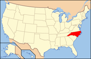
| A country | USA |
| Enters into | North Carolina |
| Adm Centre | Sparta |
| History and geography | |
| Date of education | 1859 |
| Square | 611 km² |
| Population | |
| Population | 11 155 people ( 2010 ) |
| Density | 18.3 persons / km² |
| Official site | |
 | |
 | |
Content
History
The county was formed in 1859 from the eastern part of Ash County (North Carolina) .
Law and Government
Allegheny County is a member of the Supreme State Council of Governments.
Geography
According to the United States Census Bureau , the county has a total area of 610 km², of which 610 km² is land and 2.6 km² is water. In the district center of Sparta, the average July temperature is 19.9 ° С with an average maximum of 26.5 ° С; the average January temperature is −1.3 ° С with an average minimum of −7.5 ° С [2] . Allegheny County is located in the northwestern part of North Carolina and is bordered in the north with the state of Virginia .
Neighboring counties
- Grayson County (Virginia) - North
- Surry County (North Carolina) - East
- Wilkes County (NC) - South
- District Ash (North Carolina) - West
Roads
- - US 21
- - US 221
- - NC 18
- - NC 88
- - NC 93
- - NC 113
National Protected Area
- Blue Ridge Parkway (part)
Demographics
| Population census | |||
|---|---|---|---|
| Census year | Us. | % ± | |
| 1860 | 3590 | ||
| 1870 | 3691 | 2.8% | |
| 1880 | 5486 | 48.6% | |
| 1890 | 6523 | 18.9% | |
| 1900 | 7759 | 18.9% | |
| 1910 | 7745 | -0.2% | |
| 1920 | 7403 | -4.4% | |
| 1930 | 7186 | -2.9% | |
| 1940 | 8341 | 16.1% | |
| 1950 | 8155 | -2.2% | |
| 1960 | 7734 | -5.2% | |
| 1970 | 8134 | 5.2% | |
| 1980 | 9587 | 17.9% | |
| 1990 | 9590 | 0% | |
| 2000 | 10,677 | 11.3% | |
| 2010 | 11 155 | 4.5% | |
| Current 2012 | 10,927 | -2% | |
| 1860-2012 2012 Assessment [1] | |||
According to the 2000 census, there were 10,677 people, 4,593 households, and 3,169 families residing in the county. The average population density was 18 people / km². The racial composition of the district: 95.69% White, 1.23% African American, 0.26% Native American, 0.20% Asian, 0.01% Pacific Islander, 1.75% other races, and 0.86% two more races 4.96% were Hispanic or Latino.
Out of 4,593 families, 24.80% had children under the age of 18 living with them, 58.30% of married couples, 7.50% of women living without their husbands, and 31.00% without families. 27.80% of all households were individuals and 14.00% were people aged 65 or over.
The age structure of the district: 19.40% under the age of 18 years, 7.40% from 18 to 24 years old, 26.30% from 25 to 44 years old, 27.70% from 45 to 64 years old and 19.20% between the ages 65 years and older. The average age was 43 years.
The median income for a household in the county was $ 29,244, and the median income for a family was $ 38,473. Men had an average income of $ 25,462, and women $ 18,851. The per capita income in the district was $ 17,691. About 11.30% of families and 17.20% of the population were below the poverty line, including 20.80% of those under the age of 18 and 25.00% of those aged 65 and over.
Locations
Cities
- Sparta
Townships
The county is divided into seven townships : Cherry Lane , Cranberry , Gap-Civil , Glade Creek , Poney Creek , Praters Creek and Whitehead .
Unincorporated Communities
- Cherry lane
- Glade Valley
- Laurel springs
- Payne creek
- Roring Gap
- Scottville
- Twin Oaks
Notes
- ↑ 1 2 State & County QuickFacts Unreferenced (not available link) . United States Census Bureau. The date of circulation is October 17, 2013. Archived July 6, 2011.
- ↑ IDcide.com
- ↑ US Decennial Census . Census.gov. The appeal date is October 17, 2013.