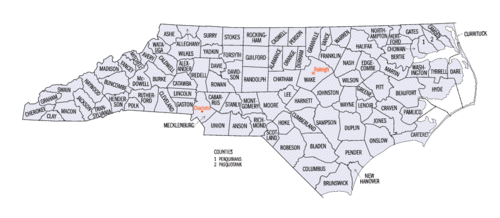
The American state of North Carolina consists of 100 counties . The state is ranked twenty-ninth in the country in terms of area and seventh in the number of counties. [one]
After the restoration of the monarchy in 1660, on March 24, 1663, King Charles II of England awarded eight people for their faithful support in his efforts to regain the throne of England. To eight grant recipients named by the owner lords, he granted land named in honor of his father Charles I - Carolina. From 1663 to 1729, Carolina was a North American British colony. Around 1729, North Carolina separated from South Carolina .
The history of North Carolina County extends over more than 340 years, from the creation of Albemarl County in 1668 to the creation of Avery and Hawk Counties in 1911.
List of counties
| Title | FIPS Code | District center [2] | Founded | Formed from [3] | Named after | Population (2011) [2] [4] [5] [6] | Area [2] [4] | Map |
|---|---|---|---|---|---|---|---|---|
| Alamans County | 001 | Graham | 1849 | Orange County | The battle of Alamans, the name of which comes from a local Native American word meaning "blue clay", found in Great Alamans Creek | 153 291 | 1,127 km² | |
| Aleggander County | 003 | Taylorsville | 1847 | Caldwell County, Iredell County and Wilkes County | William J. Alegzander, Legislative and Speaker of the North Carolina House of Commons | 37 087 | 681 km² | |
| Allegheny County | 005 | Sparta | 1859 | Ash County | The name comes from the Delaware names of the Allegheny and Ohio rivers and means "thin stream" | 11 052 | 611 km² | |
| Anson County | 007 | Wadesboro | 1750 | Bladen County | George Anson, 1st Baron Anson (1697–1762) , famous English admiral who traveled around the world | 26 143 | 1391 km² | |
| Ash County | 009 | Jefferson | 1799 | Wilkes County | Samuel Ashe (1725–1813) , revolutionary patriot, supreme judge and governor of North Carolina | 27 143 | 1106 km² | |
| Avery County | 011 | Newland | 1911 | Caldwell County, Mitchell County and Uatoga County | Whitestill Avery (1741–1821) , revolutionary soldier and Attorney General of North Carolina | 17 572 | 640 km² | |
| Beaufort County | 013 | Washington | 1712 | Initial district | Henry Somerset, Duke of Beaufort , who in 1709 became one of the lord-owners | 47 691 | 2484 km² | |
| Bertie County | 015 | Windsor | 1722 | Chovan County | James or Henry Bertie, two Lord Owners of Colonial North Carolina | 20 874 | 1919 km² | |
| Bladen County | 017 | Elizabethtown | 1734 | New Hanover County | Martin Bladen, Member of the Trade Council | 35 190 | 2297 km² | |
| Brunswick County | 019 | Bolivia | 1764 | Bladen County and New Hanover County | King of Great Britain George I (1660–1727) , Duke of Braunschweig-Luneburg | 110 097 | 2719 km² | |
| Bank District | 021 | Asheville | 1791 | Burke County and Rutherford County | Edward Bancombe, a revolutionary soldier who was wounded and captured at the Battle of Germantown and died, parole in Philadelphia | 241 419 | 1709 km² | |
| Burke County | 023 | Morganton | 1777 | Rowan County | Thomas Burke (1747–1783) , Member of the Continental Congress and Governor of North Carolina | 90 904 | 1334 km² | |
| Cabarrus County | 025 | Concord | 1792 | Mecklenberg County | Stephen Cabarrus (1754–1808) , Member of the Legislature, and Speaker of the North Carolina Commons | 181 468 | 945 km² | |
| Caldwell county | 027 | Lenoir | 1841 | Burke County and Wilkes County | Joseph Caldwell (1773–1835) , First President of the University of North Carolina | 82 395 | 1228 km² | |
| Camden County | 029 | Camden | 1777 | Pascuotank County | Charles Pratt, 1st Earl of Camden (1714–1794) , who opposed the taxation of American colonists | 10 014 | 793 km² | |
| Carteret County | 031 | Beaufort | 1722 | Craven County | John Carteret, 2nd Earl of Granville (1690–1763) , who inherited one eighth of his share in Carolina from his great-grandfather, George Carteret | 67 373 | 3473 km² | |
| Caswell County | 033 | Yancyville | 1777 | Orange County | Richard Caswell (1729–1789) , Member of the First Continental Congress and First Governor of North Carolina after the Declaration of Independence | 23 403 | 1109 km² | |
| Katoba District | 035 | Newton | 1842 | Lincoln County | Catoba tribe | 154 181 | 1,072 km² | |
| Chatham County | 037 | Pittsboro | 1771 | Orange County | William Pitt, 1st Earl of Chetham (1708–1778) , Secretary of State during the French-Indian War , and later Prime Minister of Great Britain | 64 195 | 1836 km² | |
| Cherokee County | 039 | Murphy | 1839 | Macon County | Cherokee tribe | 27 194 | 1287 km² | |
| Chovan County | 041 | Edenton | 1668 | Albemarl County | Chowan tribe | 14 831 | 603 km² | |
| Clay County | 043 | Hayesville | 1861 | Cherokee County | Henry Clay (1777–1852) , statesman and speaker representing Kentucky in the House of Representatives and Senate | 10 563 | 572 km² | |
| Cleveland County | 045 | Shelby | 1841 | Lincoln County and Rutherford County | Benjamin Cleveland (1738–1806) , Colonel of the American War of Independence , who took part in the Battle of Kings Mountain | 97 489 | 1215 km² | |
| Downtown columbus | 047 | Whiteville | 1808 | Blaiden County and Brunswick County | Christopher Columbus (1451–1507) , navigator, researcher, and one of the first Europeans to explore America | 57 712 | 2471 km² | |
| Craven County | 049 | New bern | 1705 | Bath County | William Craven, 1st Earl of Craven (1608–1697) , who was the Lord Owner in colonial North Carolina | 104 786 | 2005 km² | |
| Cumberland county | 051 | Fayetteville | 1754 | Bladen County | Prince William, Duke of Cumberland (1721–1765) , warlord and son of George II | 324 885 | 1704 km² | |
| Kerritak County | 053 | Kerritak | 1668 | Albemarl County | Traditionally considered the word of the Indians for wild geese | 23 955 | 1362 km² | |
| Dair County | 055 | Manteo | 1870 | Kerritack County, Hyde County and Tyrrell County | Virginia Dare (born 1587) , the first child born in America to English parents | 34 307 | 4046 km² | |
| Davidson County | 057 | Lexington | 1822 | Rowan County | William Lee Davidson (1746–1781) , General of the American War | 162 695 | 1469 km² | |
| Davy County | 059 | Moxville | 1836 | Rowan County | William Richardson Davy (1756–1820) , Member of the Federal Convention and Governor of North Carolina | 41 552 | 692 km² | |
| Duplin County | 061 | Canansville | 1750 | New Hanover County | Thomas Hay, Viscount Duplin (1710–1787) , who was the 9th Earl of Kinnoull | 59 542 | 2121 km² | |
| Durham County | 063 | Durham | 1881 | Orange County and Wake County | The city of Durham , named after Dr. Bartlett Snipes Durham, who donated land on which the railway station was located | 273 392 | 772 km² | |
| Edgecomb County | 065 | Tarboro | 1741 | Bertie County | Richard Edgecamb, 1st Baron Edgecamb (1680–1758) , Lord Treasurer and General Treasurer for Ireland | 56 041 | 1313 km² | |
| Forsyth County | 067 | Winston salem | 1849 | Stokes County | Benjamin Forsyth (d. 1814) , American officer during the 1812 war | 354 952 | 1070 km² | |
| Franklin County | 069 | Louisburg | 1779 | Butte County | Benjamin Franklin (1706–1790) , author, politician, statesman, and founding father of the United States | 61 140 | 1282 km² | |
| Gaston County | 071 | Gastonia | 1846 | Lincoln County | William Gaston (1778–1844) , US Congressman and Justice of the North Carolina Supreme Court | 207 031 | 943 km² | |
| Gates County | 073 | Gatesville | 1779 | Chovan County, Hertford County and Perkimans County | Horatio Gates (1727–1806) , American general during the revolutionary battle of Saratoga | 12 043 | 896 km² | |
| Graham County | 075 | Robbinsville | 1872 | Cherokee County | William Alegzander Graham (1804–1875) , US Senator , Governor of North Carolina, and United States Secretary of the Navy | 8802 | 782 km² | |
| Granville County | 077 | Oxford | 1746 | Edgecomb County | John Carteret, 2nd Earl of Granville (1690–1763) , who inherited one eighth of his share in Carolina from his great-grandfather George Carteret | 59 976 | 1391 km² | |
| Green County | 079 | Snow hill | 1799 | Dobbs County Originally named Glasgow County | Nathaniel Green (1742–1786) , Major General of the Continental Army during the US War of Independence | 21 556 | 689 km² | |
| Guildford County | 081 | Greensboro | 1771 | Orange County and Rowan County | Francis North, 1st Earl of Guildford (1704–1790) , British politician and father of British Prime Minister Frederick North | 495 279 | 1704 km² | |
| Halifax County | 083 | Halifax | 1758 | Edgecomb County | George Montague-Dunk, 2nd Earl of Halifax (1716–1771) , British activist and president of the Trade Council | 54 173 | 1893 km² | |
| Harnett county | 085 | Lillington | 1855 | Cumberland county | Cornelius Harnett (1723–1781) , American revolutionary and delegate to the Continental Congress | 119 256 | 1,557 km² | |
| Haywood County | 087 | Waynesville | 1808 | Buncombe County | John Heywood (1754–1827) , State Treasurer of North Carolina | 58 855 | 1437 km² | |
| Henderson County | 089 | Hendersonville | 1838 | Buncombe County | Leonard Henderson (1772–1833) , Chief Justice of the North Carolina Supreme Court | 107 927 | 971 km² | |
| Hertford County | 091 | Winton | 1759 | Bertie County, Chovan County and Northampton County | Francis Seymour-Conway, 1st Marquis of Hertford (1718–1794) | 24 433 | 932 km² | |
| Hawk County | 093 | Raford | 1911 | Cumberland County and Robson County | Robert Hawk (1837–1912) , general of the Confederate States of America Army during the US Civil War | 49 272 | 1015 km² | |
| Hyde County | 095 | Swan Quarter | 1712 | Initial district Originally named Wickham County | Edward Hyde (c. 1650–1712) , Governor of North Carolina | 5822 | 3688 km² | |
| Airdell County | 097 | Statesville | 1788 | Rowan County | James Ayrdell (1751–1799) , Comptroller at the Port of Edenton and one of the first judges of the US Supreme Court | 161 202 | 1546 km² | |
| Jackson County | 099 | Sylvia | 1851 | Haywood County and Macon County | Andrew Jackson (1767–1845) , 7th President of the United States | 40 285 | 1279 km² | |
| Johnston County | 101 | Smithfield | 1746 | Craven County | Gabriel Johnston (1699–1752) , Governor of Colonial North Carolina | 172 595 | 2062 km² | |
| Jones County | 103 | Trenton | 1778 | Craven County | Willy Jones (1740–1801) , opposed ratification of the US Constitution and rejected an invitation to the Constitutional Convention | 10 020 | 1225 km² | |
| Lee County | 105 | Sanford | 1907 | Chetam County and Moore County | Robet E. Lee (1807–1870) , Army Officer and General of the Confederate States of America during the US Civil War | 58 752 | 671 km² | |
| Lenoir County | 107 | Kinston | 1791 | Dobbs County Originally named Glasgow County | William Lenoir (1751–1839) , captain during the American War of Independence , who took part in the Battle of Kings Mountain | 59 339 | 1041 km² | |
| Lincoln County | 109 | Lincolton | 1779 | Trion County | Benjami Lincoln (1733–1810) , a major general during the US War of Independence who participated in the siege of Yorktown | 78 932 | 795 km² | |
| McDowell County | 111 | Marion | 1842 | Burke County and Rutherford County | Joseph MacDowell (1756–1801) , a soldier during the US War of Independence who took part in the Battle of King's Mountain | 45 104 | 1,155 km² | |
| Macon County | 113 | Franklin | 1828 | Haywood County | Nathaniel Macon (1758–1837) , member and speaker of the US House of Representatives | 34 074 | 1344 km² | |
| Madison County | 115 | Marshall | 1851 | Buncombe County and Yancy County | James Madison (1751–1836) , 4th President of the United States | 20 816 | 1,171 km² | |
| Martin County | 117 | Williamston | 1774 | Halifax County and Tyrrell County | Josiah Martin (1737–1786) , last governor of colonial North Carolina | 24 180 | 1,194 km² | |
| Mecklenberg County | 119 | Charlotte | 1762 | Anson County | Charlotte Mecklenburg-Strelitzkaya (1744–1818) , wife of King George III of Great Britain | 944 373 | 1414 km² | |
| Mitchell County | 121 | Bakersville | 1861 | Burke County, Caldwell County, McDowell County, Uatoga County and Yancy County | Elisha Mitchell (1793–1857) , professor at the University of North Carolina , who measured the height of Mount Mitchell | 15 445 | 575 km² | |
| Montgomery County | 123 | Troy | 1779 | Anson County | Richard Montgomery (1738–1775) , major general during the US War of Independence , who was killed at the Battle of Quebec | 27 667 | 1300 km² | |
| Moore County | 125 | Cartage | 1784 | Cumberland county | Alfred Moore (1755–1810) , captain during the US War of Independence and judge of the US Supreme Court | 89 352 | 1829 km² | |
| Our District | 127 | Nashville | 1777 | Edgecomb County | Francis Nash (1742–1777) , brigadier general during the US War of Independence , who was mortally wounded at the Battle of Germantown | 96 116 | 1406 km² | |
| New Hanover County | 129 | Wilmington | 1729 | Craven County | The royal family of England, members of the Hanover dynasty | 206 189 | 850 km² | |
| Northampton County | 131 | Jackson | 1741 | Bertie County | James Compton, 5th Earl of Northampton (1687–1754) , British Peer and Politician | 21 893 | 1,427 km² | |
| Onslow County | 133 | Jacksonville | 1734 | New Hanover County | Arthur Onslow (1691–1768) , speaker of the House of Commons of Great Britain | 179 716 | 2354 km² | |
| Orange County | 135 | Hillsboro | 1752 | Bladen County, Granville County and Johnston County | William V, Prince of Orange (1748–1806) , the last staffing of the Dutch Republic | 135 755 | 1,039 km² | |
| Pamlico County | 137 | Bayboro | 1872 | Beaufort County and Craven County | Pamlico Sound and the Pamlico Indians | 13 197 | 1,466 km² | |
| Pascuotank County | 139 | Elizabeth City | 1668 | Albemarl County | The name comes from the Native American word pasketanki, which means "where the current is divided." | 40 696 | 749 km² | |
| Pender County | 141 | Bergou | 1875 | New Hanover County | William Dursi Pender (1834–1863) , a soldier of the Confederate States of America who was mortally wounded at the Battle of Gettysburg during the US War of Independence | 53 399 | 2416 km² | |
| Perkimans County | 143 | Hertford | 1668 | Albemarl County | Perkimans tribe of Indians | 13 487 | 852 km² | |
| Person County | 145 | Roxborough | 1791 | Caswell County | Thomas Person, Patriot of the American Revolutionary War | 39 637 | 1046 km² | |
| Pitt County | 147 | Greenville | 1760 | Beaufort County | William Pitt, 1st Earl of Chetham (1708–1778) , Secretary of State during the French-Indian War , and later Prime Minister of Great Britain | 171 134 | 1696 km² | |
| Polk County | 149 | Columbus | 1855 | Henderson County and Rutherford County | William Polk (1758–1834) , officer during the US War of Independence and first president of the North Carolina State Bank | 20 256 | 619 km² | |
| Randolph County | 151 | Ashborough | 1779 | Guildford County | Peyton Randolph (c. 1721–1755) , first president of the Continental Congress | 142 358 | 2046 km² | |
| Richmond County | 153 | Rockingham | 1779 | Anson County | Charles Lennox, 3rd Duke of Richmond (1735–1806) , staunch supporter of American colonists ; advocated the elimination of British troops | 46 611 | 1243 km² | |
| Robson County | 155 | Lumberton | 1787 | Bladen County | Thomas Robson, Officer during the Revolutionary War | 135 517 | 2463 km² | |
| Rockingham County | 157 | Wentworth | 1785 | Guildford County | Charles Watson-Wentworth, 2nd Marquis of Rockingham (1730–1782) , British statesman and two-time prime minister of Great Britain | 93 329 | 1,481 km² | |
| Rowan County | 159 | Salisbury | 1753 | Anson County | Matthew Rowan (born 1769) , was Acting Governor of Colonial North Carolina after the death of Governor Nathaniel Rice | 138 019 | 1357 km² | |
| Rutherford County | 161 | Rutherfordton | 1779 | Trion County | Griffith Rutherford (c. 1721–1805) , officer during the US War of Independence and political leader in North Carolina | 67 538 | 1,466 km² | |
| Sampson County | 163 | Clinton | 1784 | Duplin County | John Sampson, Board Member, Josiah Martin | 63 734 | 2453 km² | |
| Scotland County | 165 | Lorinberg | 1899 | Richmond County | Country Scotland , part of Great Britain | 35 861 | 831 km² | |
| Stanley County | 167 | Albemarl | 1841 | Montgomery County | John Stanley (1774–1834) , US Congressman and Speaker of the North Carolina House of Commons | 60 636 | 1046 km² | |
| Stokes County | 169 | Danbury | 1789 | Sarri County | John Stokes, soldier during the American Revolution who was badly wounded at the Battle of Waxho | 47 242 | 1,181 km² | |
| Sarri County | 171 | Dobson | 1771 | Rowan County | County Surrey | 73 714 | 1393 km² | |
| Swain County | 173 | Bryson city | 1871 | Jackson County and Macon County | David Lowry Swain (1801–1868) , Governor of North Carolina and President of the University of North Carolina | 14 043 | 1,401 km² | |
| Transylvania District | 175 | Brevard | 1861 | Henderson County and Jackson County | Comes from the Latin words: trans , meaning through and sylva , meaning forest | 32 820 | 987 km² | |
| Tyrrell County | 177 | Colombia | 1729 | Chovan County, Kerritak County and Pasquotac County | John Tyrell, was a Lord in the past | 4364 | 1554 km² | |
| Union County | 179 | Monroe | 1842 | Anson County and Mecklenberg County | The name was invented as a compromise after a dispute between local Whigs and Democrats about how the district should be called: Clay or Jackson | 205 463 | 1658 km² | |
| Vance County | 181 | Henderson | 1881 | Franklin County, Granville County and Warren County | Zebulon Baird Vance (1830–1894) , officer of the Confederate States of America during the American Civil War , twice Governor of North Carolina and Senator of the United States | 45 307 | 699 km² | |
| Wake County | 183 | Roles | 1771 | Cumberland County, Johnston County and Orange County | Margaret Wake, wife of British colonial governor William Tryon | 929 780 | 2220 km² | |
| Warren County | 185 | Warrenton | 1779 | Butte County | Joseph Warren (1741–1775) , patriot and private volunteer who was mortally wounded at the Battle of Bunker Hill | 20 861 | 1150 km² | |
| Washington County | 187 | Plymouth | 1799 | Tyrrell County | George Washington (1732–1799) , 1st President of the United States | 12 973 | 1,098 km² | |
| Uatoga County | 189 | Bun | 1849 | Ash County, Caldwell County, Wilkes County and Yancy County | The Uatoga River, whose name is derived from an Indian word meaning "beautiful water" | 51 333 | 811 km² | |
| Wayne County | 191 | Goldsboro | 1779 | Dobbs County Originally named Glasgow County | Anthony Wayne (1745–1796) , general during the American Revolutionary War | 123 697 | 1,443 km² | |
| Wilkes County | 193 | Wilkesboro | 1777 | Sarri County | John Wilkes (1725–1797) , English radical , journalist and politician | 68 984 | 1968 km² | |
| Wilson County | 195 | Wilson | 1855 | Edgecomb County, Johnston County, Nash County and Wayne County | Louis D. Wilson, member of the state legislature for Edgecomb County, who died of a fever in Veracruz during the Mexican-American War | 81 452 | 969 km² | |
| Yadkin County | 197 | Corekinville | 1850 | Sarri County | Yadkin River | 38 279 | 873 km² | |
| Yancy County | 199 | Burnsville | 1833 | Buncombe County and Burke County | Bartlett Yancy (1785–1828) , US Congressman , Speaker of the North Carolina Senate; previously defended North Carolina Public School System | 17 701 | 811 km² |
Historic Districts
| Title | Created by | Abolished | Reason for Abolition |
|---|---|---|---|
| Albemarl | 1664 [7] | 1689 [7] | Crashed into districts: Chovan , Kerritak , Pasquotank and Perkimans |
| Bat | 1696 [8] | 1739 [8] | Renamed Craven County |
| Beat | 1764 [9] | 1779 [9] | Crashed into Franklin County and Warren County |
| Dobs | 1758 [10] | 1791 [10] | Crashed into counties: Green , Lenoir and Wayne |
| Trion | 1768 [11] | 1779 [11] | Crashed into Lincoln County and Rutherford County |
Notes
- ↑ How Many Counties are in Your State? . Click and Learn. Date of treatment August 26, 2009. Archived April 22, 2009.
- ↑ 1 2 3 NACo - Find a county (unavailable link) . National Association of Counties . Date of treatment March 5, 2014. Archived December 11, 2011.
- ↑ County Histories . The State Library of North Carolina . Date of treatment August 31, 2011.
- ↑ 1 2 North Carolina QuickFacts . US Census Bureau . Date of treatment February 6, 2008. Archived April 3, 2013. (2000 Census)
- ↑ Census Tables for 2009 . US Census Bureau . Date of treatment February 15, 2011.
- ↑ 2010 Census . US Census Bureau . Date of treatment March 2, 2011.
- ↑ 1 2 Historic Albemarle County North Carolina Genealogy . USGenNet. Date of treatment July 24, 2008.
- ↑ 1 2 Historic Bath County North Carolina Genealogy . USGenNet. Date of treatment July 24, 2008.
- ↑ 1 2 Bute Co., North Carolina GenWeb 1764–1779 . RootsWeb. Date of treatment July 24, 2008.
- ↑ 1 2 Dobbs County, NC GenWeb Archives . USGenWeb. Date of treatment July 24, 2008. Archived July 23, 2008.
- ↑ 1 2 Finding Tryon County Ancestors . Gaston-Lincoln Regional Library System. Date of treatment August 31, 2011. Archived October 1, 2011.