Gobduntau , Gubduntau [1] ( Uzbek G'ubdintog '/ Ғubdintoғ; Habduntog' / Ҳabduntoғ ) - a mountain range on the border of the Jizzakh and Samarkand region of Uzbekistan [2] , the southern chain as a part of the Nurata mountains [3] .
| Gobduntau | |
|---|---|
| Uzbek G'ubdintog ', Habduntog' | |
 In the mountains of Gobdontau. Valley of Say Ingichka | |
| Specifications | |
| Length | more than 30 km |
| Highest point | |
| Absolute height | 1672.8 m |
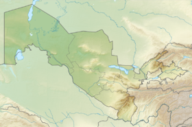
| Location | |
| A country |
|
| Mountain system | Nurata Range |
Content
Description
The Gobduntau mountain range stretches from west to east (with a slight slope to the south) for more than 30 km. In the north, it is separated from the remaining ranges of the Nurata mountains by the Koytash depression , and in the south it is bounded by the Zeravshan valley [3] . The highest point (without a name) is located at an altitude of 1672.8 m [2] [3] , the average height is 700-1000 m [3] . The border of the Samarkand and Jizzakh regions was drawn along the ridge ridge [2] .
The mountains are composed of Paleozoic schists , sandstones and limestones , forming an anticlinal structure. The slopes are cut with a large number of sai [com 1] , dry channels and ravines [3] .
The climate is continental , dry. Winter is relatively cold, with an average January temperature of –2 ° C; summers are hot, the average July temperature is 20-25 ° C. The average annual rainfall is 500 mm [3] .
Economic Use
The lands at the foot and in the lowlands of the Gobduntau are used for rainfed farming and as summer pastures [3] . On the slopes of the ridge are many sheep farms [2] . In the eastern part of the mountains, the Marjanbulak gold deposit is being developed [3] .
Notes
- Comments
- ↑ Sayas in Central Asia refer to ravines with permanent or temporary watercourses, as well as the watercourses themselves (in particular, relatively small rivers experiencing sharp seasonal fluctuations in full flow or completely drying up)
- Sources
- ↑ Samarkand region. Political and administrative map background. Scale 1: 400 000. Tashkent: "Goskomgeodezkadastr", 2008. ISBN 978-9943-15-066-9
- ↑ 1 2 3 4 Map sheet J-42-3 Krasnogvardejsk . Scale: 1: 100,000. State of the terrain for 1985. 1989 Edition
- ↑ 1 2 3 4 5 6 7 8 Ғubdintoғ - National Encyclopedia of Uzbekistan . - Tashkent, 2000-2005. ( Uzbek )
Literature
- Ғubdintoғ - National Encyclopedia of Uzbekistan . - Tashkent, 2000-2005. ( Uzbek )