Palyarynat - a river in the Far East of Russia , flows through the territory of the Chaunsky district of the Chukotka Autonomous Region . The river is 48 [2] km long.
| Palyarynnat | |
|---|---|
| Characteristic | |
| Length | 48 km |
| Watercourse | |
| Source | |
| • Location | Palyanai Mountain |
| • Coordinates | |
| Mouth | Palyavaam |
| • Height | > 70 m |
| • Coordinates | |
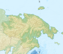
| Location | |
| Water system | Palyavaam → Chaun-Palyavaam → East Siberian Sea |
| A country |
|
| Region | Chukotka Autonomous Okrug |
| Area | Chaunsky district |
| HWR code | |
The name translated from Chukot. - "a place of discharge of horns by the mountain" [3] .
It originates from the northeastern slopes of Mount Palyanai , flows through wetlands surrounded by numerous lakes, and flows into Palyavaam on the right. In the middle course, on the left bank of the river there is an ice hill 5 m high.
Main tributaries: Marshy, Goose.
In the headwaters of Palyarynnat, ore occurrences of molybdenum were discovered [4] .
Notes
- ↑ Surface Water Resources of the USSR: Hydrological Understanding. T. 19. Northeast / ed. Yu. N. Komarnitskaya. - L .: Gidrometeoizdat, 1966 .-- 602 p.
- ↑ State Water Register . River Mal. Kalenmuwaam . textual.ru . Ministry of Natural Resources of Russia (March 29, 2009). Date of treatment December 20, 2018. Archived March 29, 2009.
- ↑ Leontyev V.V. , Novikova K.A. Toponymic Dictionary of the North-East of the USSR / scientific. ed. G. A. Menovschikov ; FEB AN USSR . North-East complex. Research institutes. Lab archeology, history and ethnography. - Magadan: Magad. Prince Publishing House , 1989 .-- S. 429. - 456 p. - 15,000 copies. - ISBN 5-7581-0044-7 .
- ↑ GeoKniga unopened (inaccessible link) . Date of treatment January 20, 2014. Archived on February 3, 2014.