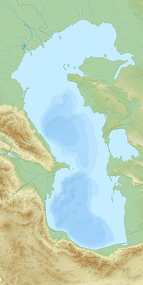
The Turkmen Bay ( Turkmen. Turkmen aýlagy ) is a vast ice-free bay in the eastern part of the Caspian Sea , which forms part of the coastline of Turkmenistan . From north to south it stretches for 80-90 km, from west to east about 80 km. The total area of the water reaches about 1600 km². In the north it is bounded by the Cheleken Peninsula from the Krasnovodsk Bay , in the west of the Caspian Sea it is separated by the sandy island of Ogurchinsky . It connects with the Caspian Sea in the south and also in the west through the Cheleken-Ogurchinsky Strait . The coastline in the eastern part of the bay is indented, subject to seasonal, annual and secular fluctuations, tied to fluctuations in the level of the Caspian Sea. There are many small bays ( Ergigen , Nedzhimguli , Nemedjar , Khokel , Karatau , Uzunada , Toutli ) and one larger - Ajaada [1] . During their drying in the tops of the bays extensive salt marshes are formed. In the northern part of the Turkmen Bay, the South Cheleken Bay stands out, fenced off from the Caspian Sea in the west by the sandy spit Dervish . The prevailing depths of the Turkmen Bay in the east are 3-4 meters, toward the center it gradually drops to 9-11 meters. The water in the Turkmen Bay is more saline than in the Caspian on average, since not a single river flows into it. Used for shipping. Flows counterclockwise.
| Turkmen bay | |
|---|---|
| Turkm. Turkmen aýlagy | |
| Characteristics | |
| Bay Type | The bay |
| Deepest | approx. 0.11 m |
| Average depth | 5-6 m |
| Salinity | 20-22 ‰ |
| Location | |
| Upstream water area | Caspian Sea |
| A country |
|
| Velayat | Balkan province |
Notes
- ↑ Map sheet J-39-XII . Scale: 1: 200 000. Indicate the date of issue / condition of the area .