Aleksandrovskoe reservoir - channel reservoir on the river Mokry Merchik ( Dnieper basin). The reservoir was built in 1973 and belongs to the Krasnokutsk inter-district water management of the Kharkiv region . The reservoir was built in 1977 according to a project of the Kharkov branch of the Ukrgiprovodkhoz Institute. The purpose is to moisten drained lands in the floodplains of the Merla and Merchik rivers for fish farming. The type of regulation is seasonal.
| Aleksandrovskoe reservoir | |
|---|---|
| ukr Oleksandrіvske vidsohovishche | |
 Aleksandrovskoe reservoir (Khark. Region). View from the right bank | |
| Morphometry | |
| Height above sea level | 133.5 m |
| Dimensions | 6.35 × 0.55 km |
| Square | 3.52 km² |
| Volume | 0,0114 km³ |
| Deepest | 6.5 m |
| Average depth | 3.21 m |
| Location | |
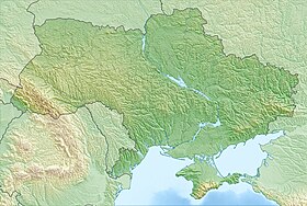
| A country |
|
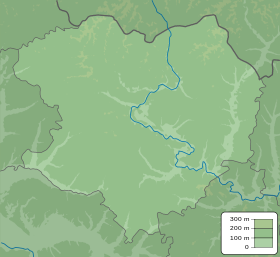
| Region | Kharkov region |
| Areas | Valkov district , Bogodukhov district |
Main parameters of the reservoir
- Normal retaining level - 133.5 m;
- Forced retaining level - 133.8 m;
- Total volume - 11.4 million m³;
- Useful volume - 10.8 million m³;
- Length - 6.35 km;
- Average width - 0.55 km;
- Maximum width - 1.60 km;
- The average depth is 3.21 m;
- The maximum depth is 6.5 m.
Basic hydrological characteristics
- The catchment area is 193 km².
- The annual flow of 50% of the security is 10,800,000 m³.
- Flood flow of 50% of security - 7,800,000 m³.
- The maximum water consumption of 1% security is 116 m³ / s.
Composition of waterworks
- Deaf earth dam with a length of 669 m, a height of 8.7 m, and a width of 8.5 m. The uphill slope is 1: 8, the bottom slope is 1: 2.5.
- Mine spillway of monolithic reinforced concrete with dimensions of 7.0 x9, 5 g.
- Spillway tunnel length - 32.4 m, size 3 (2.5 x3, 0)
- A water outlet is tubular from a steel pipe with a diameter of 400 mm for supplying water to the rimfelt located in the downstream.
Reservoir use
The reservoir was built to moisten drained lands in the floodplains of the Merla and Merchik rivers. Also, the reservoir is used to supply water to the hatchery of the Bogodukhov Fish Farm ARVC. The water area of the reservoir is used for fish farming.
Literature
- Vodogospodarsky passport Oleksandrіvskogo vodoshovische, Kharkivdіprovodgosp, 1979.
- Palamarchuk M.M., Zakorchevna N. B. Vodny Fund of Ukraine: Dovidnikiy Assistant / For Ed. V.M. Khoruva, K.A. Aliyova. K .: Nika-Center, 2001. 392 p.
- Work on inventory of rivers and reservoirs of the Kharkiv region with the development of a special procedure for the withdrawal of water resources from agricultural use, UkrNIIEP, Kharkov, 1999. 389 p.