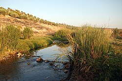
Afrin ( Arabic: عفرين , Kurdish. Efrîn , Lat. Ufrenus ) is a river in Syria and Turkey . The length of the river is 131 kilometers, the basin area is 3920 km 2 [1] .
| Afrin | |
|---|---|
| Arab. عفرين | |
 about 8 km south of Afrin about 8 km south of Afrin | |
| Characteristic | |
| Length | 131 km |
| Pool | 3920 km² |
| Watercourse | |
| Source(T) (B) | |
| • Location | Turkey |
| • Height | 678 m |
| • Coordinates | |
| Mouth | Al-asi |
| • Location | near the city of Antakya |
| • Height | 80 m |
| • Coordinates | |
| Location | |
| Water system | Al-Asi → Mediterranean Sea |
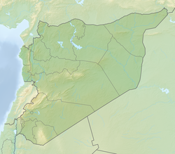
| Country |
|
| Regions | Gaziantep , Kilis , Aleppo , Hatay |
The river originates in the mountains in southern Turkey at an altitude of 678 meters above sea level [2] , flows in a south-westerly direction through the regions of Gaziantep , Kilis , and then enters the territory of the Afrin region of the Syrian Aleppo governorate. It falls in the Turkish province of Hatay in the Orontes [3] [4] . In the lower reaches, from the city of Reyhanli to the mouth, the river is canalized [5] .
The main tributaries are Sarafti [5] , Sabun, Delichai [6] (right), Kynadzhik, Dostalli [7] (left).
Major cities in the river valley are Reyhanly [5] and Afrin [5] .
Notes
- ↑ "7: Orontes River Basin" , Inventory of Shared Water Resources in Western Asia , Beirut: UN-ESCWA and BGR (United Nations Economic and Social Commission for Western Asia; Bundesanstalt für Geowissenschaften und Rohstoffe), 2013
- ↑ Map sheet J-37-99 Gaziantep . Scale: 1: 100,000. State of the terrain for 1987. 1990 edition
- ↑ Antakya Chamber of Commerce: Geographical location (inaccessible link) . Archived on October 8, 2010.
- ↑ Guy Le Strange, Palestine Under the Moslems: A Description of Syria and the Holy Land from AD 650 To 1500 (1890), p. 60 .
- ↑ 1 2 3 4 Map sheet J-37-31 Khozat . Scale: 1: 100,000. 1973 edition.
- ↑ Map sheet J-37-25 Gemerek . Scale: 1: 100,000. State of the terrain for 1985. 1990 edition
- ↑ Map sheet of J-37-26 Altynayayla . Scale: 1: 100,000. State of the terrain for 1986. 1990 edition