Bialskopodlaskie Voivodeship ( Polish województwo bialskopodlaskie ) - existed in Poland in the period 1975 - 1998 as the main units of the administrative division of the country .
| Voivodship | |||
| Bialskopodlaskie Voivodeship | |||
|---|---|---|---|
| polish Województwo bialskopodlaskie | |||
| |||
| A country | |||
| Adm. center | Biala Podlaska | ||
| History and Geography | |||
| Date of formation | June 1, 1975 | ||
| Date of Abolition | December 31, 1998 | ||
| Area | 5348 km² | ||
| Population | |||
| Population | 309 900 people ( 1998 ) | ||
| Density | 57.94 people / km² | ||
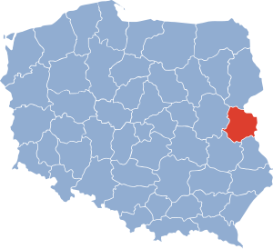 | |||
One of the 49 voivodships of Poland that were abolished as a result of the 1998 administrative reform . Covers an area of 5348 km². In 1998, there were 309,900 inhabitants. The capital of the region was the city of Biala Podlaska .
In 1999, the territory of the voivodship was for the most part transferred to the Lublin Voivodeship and several communes (the present Losycy County ) to the Masovian Voivodeship .
Content
- 1 Cities
- 2 population
- 3 notes
- 4 Literature
Cities
Cities of Bialskopodlaskie Voivodeship by the number of inhabitants (as of December 31, 1998 [1] ):
- Biala Podlaska (58 351)
- Miedzyrzec Podlaski (18,274)
- Radzyn Podlaski (16 852)
- Parchev (11 090)
- Losice (7772)
- Terespol (6079)
Population
| Year | 1975 | 1980 | 1985 | 1990 | 1995 | 1998 |
| Population | 280,400 | 286,400 | 297,900 | 305 300 | 309,500 | 309,200 |
Notes
- ↑ Bank Danych Lokalnych : Ludność wg miejsca zameldowania / zamieszkania i płci (NTS-5, 1995-2013): faktyczne miejsce zamieszkania
Literature
- Historyczny atlas Polski. - Warsz. : Wydawnictwo Demart, 2011 .-- pp. 122-123. - ISBN 978-83-7427-323-7 .