Galtgarben (in documents of the Great Patriotic War era, Bismarck ’s height and height 111.4 [1] ) is a mountain located on the territory of the Sambian Peninsula of the Kaliningrad Region of the Russian Federation . Height - 110.4 meters above sea level - the highest point of the peninsula. Until March 1, 1945 the top of the mountain was crowned by the Bismarck Tower , erected by the efforts of the Pan-German Union and opened on September 23, 1906, which in February 1945, the commander of the 43rd Army of the Red Army, General Beloborodov used as an observation post.
| Galtgarben | |
|---|---|
| Russian Galtgarben , German. Galtgarben | |
 Galtgarben in the winter of 1928 | |
| Highest point | |
| Absolute height | 110.4 m |
| Location | |
| A country |
|
| The subject of the Russian Federation | Kaliningrad region |

Content
- 1 Description
- 2 History
- 2.1 Prussian and German background
- 2.2 World War II
- 2.3 Post-war time
- 3 notes
- 4 Literature
Description
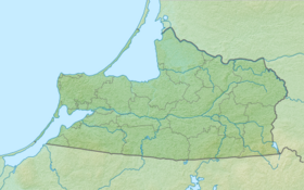
Galtgarben Mountain is located in the central part of the Sambian (Zemland) Peninsula, 20 km from Kaliningrad, not far from the highway to the western part of the peninsula and to the coast of the Baltic Sea. Surrounded on three sides by forest-covered hills, it is invisible to others, and only the treeless western part gives it away.
Prior to the outbreak of hostilities in February 1945, there were many small settlements. But during the fighting in February, March and April 1945, most of them were completely or partially destroyed, becoming landmarks of numerous military graves. All this gradually disappeared from the face of the earth, then - during prolonged battles, and in peacetime - as a result of economic activity and reburial work.
The names of the fallen warriors of the victorious party — over 10 thousand people — found from archival data, are placed on the slabs of memorial complexes on the mass graves of Soviet soldiers in the villages of Cherepanovo [2] , Russkoye [3] , Romanovo [4] and Pereslavskoye [5] .
History
Prussian and German background
Galtgarben Mountain has long attracted the attention of both local residents and alien conquerors. Various constructions were erected on it, legends spoke about it and tell it [6] , but it was always an observation point.
Until 1945, in winter, the mountain was used as a mini-ski resort.
World War II
On the night of March 1, 1945, a significant division of the Germans secretly penetrated the top of the mountain. Due to fears that the tower and the mountain would be occupied by the enemy, the tower was blown up, and the top of the mountain was fired by Katyusha rockets.
“My NP was located at an altitude of 111.4. Generally speaking, this is not a height, but a skyscraper. But here, on the flat Lowland of Zemland, it really seemed like a mountain. Locals called it “Mount Bismarck”. On its top was built a stone pyramid. Climbing up the steep steps to the site of the pyramid, I involuntarily recalled how Bismarck had warned compatriots about the uselessness and danger of a military conflict with Russia ” [1] . Beloborodov A.P. Always in battle.
After the breakthrough of the Königsberg - Kranz line by Soviet troops in late January 1945, the enemy’s resistance was broken. Galtgarben Mountain (Bismarck, height 111.4) and the village of Kumenen [7] . were busy in passing. Sweeping the fragmented Volkssturm detachments, Soviet troops marched southwest, cutting off Koenigsberg from the Zemland group of German troops, to Fischhausen Bay and the sea, to the Pillau naval fortress. On January 31, 1945, the 87th Guards Division entered the gulf near the village of Gross Heidecrug . And on February 3, 1945, the Germans were captured by the soldiers of the 91st Guards Rifle Division of the 39th Army. But the enemy’s resistance increased. The Germans by sea transferred combat units to other parts of the front to the peninsula. In the area of Germau there were heavy bloody battles. On February 9, the enemy occupied Germau. The front line approached Galtgarben and the village of Kumenen.
“The height of 111.4 was now 3-4 km from the front line. From the stone pyramid overlooking the entire treeless plain. A gray ribbon of the Konigsberg highway cut through to her right. There, over a cluster of red-brick houses of Kumenen, a Gothic spire of a church stuck out. And right to the west, the snowy fields smoked with explosions of hundreds of shells and mines ” [1] . Beloborodov A.P. Always in battle.
The weather was frosty. Heavy tanks moved freely on frozen ground. The Germans persistently tried to break through to the besieged Königsberg past Kumenin, bypassing the forest on Pobetino and, directly, through Mount Galtgarben. The approaches to Galtgarben were defended by the 87th Guards, and the 263rd Infantry Divisions defended to Kumenin.
“The main combat load in the February battles fell on the personnel of the 87th Guards Division General Kirill Yakovlevich Tymchyk and the 263rd Sivash Division, Colonel Cornelius Georgievich Cherepanov . Both of them firmly controlled units and subunits, quickly and decisively eliminated individual tank breakthroughs and enemy infantry ” [1] . Beloborodov A.P. Always in battle.
After an unsuccessful attempt by the Germans to capture Galtgarben on the night of March 1, 1945, the military situation in this direction stabilized. Under the cover of Mount Galtgarben and the forests surrounding it, Soviet troops prepared for the assault on Koenigsberg from the north-western side. By April 6, 1945, the positions of units of the 43rd and 39th armies in the area of the mountain were transferred to units of the 5th army. After the capture of Köningsberg from April 9, 1945, fighting on the western approaches of Mount Galtgarben resumed with renewed vigor. There was a liquidation of the Zemlandic German group.
Post-war time
At the end of the 1940s and until the beginning of the 1950s, the top and slopes of Galtgarben Mountain were a wasteland pitted with explosions. All buildings on and near the mountain were demolished to the ground. To the northwest of the mountain on the territory of the former villages of Nastrenen and Dallvenen was a prison camp. A dirt road passed from the camp along the northern slope of the camp with a highway exit to Kaliningrad. From the north-eastern slope of the mountain, through the forest, along an abandoned road, you could go to the village of Voroshilovo (now part of the village of Pereslavskoye). In 1946, immigrants from the Yaroslavl region came here. They called Mount Galtgarben - "hill".
In 1985, the Memorial complex and the mass grave of Soviet soldiers were opened in the village of Pereslavskoye. In addition to the soldiers buried here in 1945, the remains of soldiers from the military cemeteries of the village of Kumachevo and other environs of the Galtgarben mountain were transferred here. The 87th Guards , 263rd , 182nd , 144th Rifle Divisions, separate penal army companies (Oshar) of the 43rd and 5th armies and the 10th frontier squadron suffered the greatest losses here. On the memorial slabs of the complex, 5165 [8] names of the fallen soldiers are applied.
Notes
- ↑ 1 2 3 4 Beloborodov A.P. Always in battle. - Moscow: Economics, 1984.
- ↑ Cherepanovo
- ↑ Russian
- ↑ Romanovo
- ↑ Pereslavl
- ↑ Galtgarben (German)
- ↑ Kumachevo (Russian)
- ↑ List of buried (immortalized) warriors
Literature
- Kucheryavy P.P., Fedorov G.M. Geography of the Kaliningrad region. - Kaliningrad: Kaliningrad Book Publishing House, 1989.P. 33 - 35.
- Beloborodov A. P. "Always in battle." From Tilsit to Bismarck Mountain
- Isaac Kobylyansky. "Direct fire on the enemy." Fight at an altitude of 111.4
- Vasilevsky A. M. “The Work of All Life”. In the spring of the 45th in East Prussia