ISO 3166-2: PW - International Organization for Standardization standard that defines geocodes. It is a subset of the standard ISO 3166-2 related to Palau . The standard covers 16 states of Palau. Each geocode consists of two parts: the Alpha2 code according to the ISO 3166-1 standard for Palau - PW and an additional code written through a hyphen. Additional code is formed by a three-digit number. Palau state geocodes are a subset of the top-level domain code - PW , assigned by Palau in accordance with ISO 3166-1 .
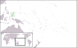 Palau on a world map Palau on a world map | |
| Geocodes according to ISO 3166-1 | |
| Alpha2 code | Pw |
| Alpha3 code | Plw |
| Digital code | 585 |
Content
Palau Geocodes
Geocodes of 16 states of the administrative-territorial division of Palau.
| Geocode | Administrative unit | Status |
|---|---|---|
| PW-002 | Aimeliic | state |
| Pw-218 | Ngarhelong | state |
| PW-004 | Airai | state |
| PW-222 | Ngardmau | state |
| PW-010 | Angaur | state |
| PW-224 | Ngatpang | state |
| PW-050 | Hatochobei | state |
| PW-226 | Nghesar | state |
| PW-100 | Kayangel | state |
| Pw-227 | Ngarelengui | state |
| Pw-150 | Koror | state |
| Pw-228 | Ngival | state |
| Pw-212 | Melekeok | state |
| Pw-350 | Peleliu | state |
| Pw-214 | Ngaraard | state |
| Pw-370 | Sonsorol | state |
Geocodes of Border States of Palau
- Indonesia - ISO 3166-2: ID (in the west, in the south (maritime border)),
- Philippines - ISO 3166-2: PH (in the northwest (maritime border)),
See also
- ISO 3166-1
- ISO 3166-2
- Administrative division of Palau