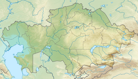
Shalkarteniz [1] [2] ( Chelkartengiz [2] , Chelkar-Tengiz [3] ; Kazakh. Shalkartez_z - boundless sea ) - a saline , partially swampy depression in the lower reaches of the Turgai River in Kazakhstan . Located in the south of Aktobe region , 160 km north-west of the city of Aral . The minimum mark is 49 meters above sea level [4] . The total area of salt marshes reaches 1,800 km² [2] . Until the end of the XVI century, the basin was filled with the waters of the once more high-water Turgai River, which then broke through towards the Aral Sea [5] . After the shoaling of the river, the reservoir lost contact with the Aral Sea basin. In the south, sandy deserts surround the depression. In the spring, the branches of the Turgai River flow into the Shalkarteniz, and it turns into a shallow, bitter-salty lake (depth up to 3 m). On the pre-war maps, the basin was designated as a single lake. Due to the growth of water intake from the Turgai and Irgiz Shalkarteniz rivers, it dried out and turned into litter and during the 1960s was a desert salt marsh in the Aktobe region of the Kazakh SSR . However, the many snowy winter of 1969-1970 became the cause of an early and unusually abundant flood on the rivers of the Turgai Hollow . High floods repeated in 1971 and 1972. As a result of filling the hollow, flamingos returned to the islands of the lakes of the hollows, which established summer nesting colonies [6] . Currently, there are 8 lakes of different size and salinity fed by the flood waters of the Turgai River near the basin, the largest of which are Kurdym , Caracol and Zhyngyldy [7] .
| Shalkarteniz | |
|---|---|
| kaz Shalkarte | |
| Morphometry | |
| Absolute height | 55 m |
| Square | 1,800 km² |
| Pool | |
| Flowing rivers | Turgai , Zhyngyldiozek , Tegene |
| Location | |
| A country |
|
| Region | Aktobe region |
| Area | Irgiz district |

Notes
- ↑ Map sheet M-41 .
- ↑ 1 2 3 Shalkarteniz - an article from the Great Soviet Encyclopedia .
- ↑ Chelkar-Tengiz // Short Geographical Encyclopedia, Volume 4 / Gl.red. A. A. Grigoriev. Moscow: Soviet Encyclopedia - 1964
- ↑ Topographic map of 1: 200 000 scale M-41-XXXIV
- ↑ Aral Sea and the causes of its death. - My articles - Catalog of articles - Jiga Beclar Maconi Neopr (Inaccessible link) . The date of circulation is May 27, 2013. Archived November 29, 2014.
- ↑ Lake Shalkarteniz (Chelkar-Tengiz)
- ↑ Turgai - Yandex. Cards