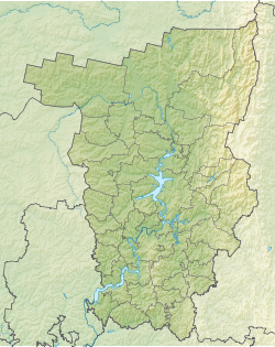
Lupya (from the Komi-Perm. Lop - felling, or Mans. Lup - driftwood, I am a river) - a river in the Gaynsky district of the Perm Territory . The mouth of the river is 1181 km along the left bank of the Kama River . The length of the river is 128 km. The catchment area is 1380 km² [2]
| Loupe | |
|---|---|
| Characteristic | |
| Length | 128 km |
| Pool | 1380 km² |
| Watercourse | |
| Source | |
| • Height | above 202.3 m |
| • Coordinates | |
| Mouth | Kama |
| • Location | 1181 km on the left bank |
| • Height | 126.5 m |
| • Coordinates | |
| River slope | 0.4 m / km |
| Location | |
| Water system | Kama → Volga → Caspian Sea |
| A country |
|
| Region | Perm region |
| Area | Gain district |
| HWR code | |
The source in the Northern Uvaly near the border with the Republic of Komi . The source lies on the watershed of the Volga and Northern Dvina basins; near the source of Lupya are the sources of small tributaries of the Voch river. Flowing south. The average catchment height is 191 m. The average slope is 0.4 m / km [3] .
In the middle reaches, on the left bank of the river, the village of Zhemchuzhny ( Kebrat rural settlement ). Also, the river flows through several non-residential villages.
It flows into Kama above the village of Kebrati (the center of the Kebrat rural settlement ). The width of the river near the mouth is about 30 meters.
Tributaries
The largest tributaries are Sochi (left) and Sugrem (right).
- 32 km: Wuzhan River (ave)
- 41 km: Soch river (lv)
- Anshor River (lv)
- 53 km: Lumya river (pr)
- 65 km: Veria river (pr)
- 86 km: Choi River (ave)
- 99 km: river Shugrem (pr)
- 107 km: Dzelya-Alach river (lv)
- 107 km: Idzhid-Alach river (lv)
- Malaya Lupya river (pr)
Water registry data
According to the state water register of Russia, it belongs to the Kama basin district , the Kama river water sector from the source to the water gauge near the village of Bondyug , the river sub-basin - the Kama tributary basins to the confluence of the White. The river basin of the river is Kama [2] .
The code of the object in the state water register is 10010100112111100002003 [2]
Links
- ↑ Surface Water Resources of the USSR: Hydrological Understanding. T. 11. The Middle Urals and the Urals. Vol. 1. Kama / ed. V.V. Nikolaenko. - L .: Gidrometeoizdat, 1966 .-- 324 p.
- ↑ 1 2 3 State Water Register . Lupya . textual.ru . Ministry of Natural Resources of Russia (March 29, 2009). Date of treatment December 20, 2018. Archived March 29, 2009.
- ↑ Encyclopedia of the Perm Region - Lupya (inaccessible link) . www.perm1.ru . Date of treatment March 31, 2019. Archived February 17, 2008.