Glubochinsky reservoir [2] (option: Glubochensky pond [3] [4] ) - a reservoir on the Glubokaya river (the Chusovoy river basin) in the Polevsky city district of the Sverdlovsk region . Created in the XIX century to provide water to metallurgical plants in the city of Polevskoy .
| Glubochinskoe reservoir | |
|---|---|
| Morphometry | |
| Height above sea level | 411 m |
| Dimensions | 2 × 0.8 km |
| Area | 1.5 km² |
| Deepest | 20 m |
| Average depth | 5 m |
| Characteristics | |
| Year of filling | 1887 |
| Swimming pool | |
| Flowing watercourses | Deep , Stone |
| Flowing streams | Deep , bright |
| Location | |
| A country |
|
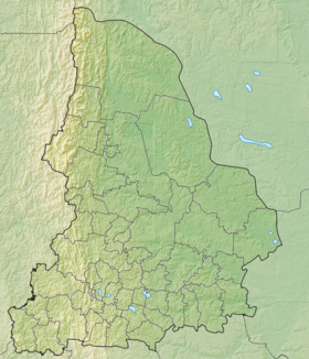
| The subject of the Russian Federation | Sverdlovsk region |
| HWR code | |

Content
- 1 History of creation
- 2 Description
- 3 Literature
- 4 notes
- 5 Links
Creation History
The construction of Seversky and Polevsky factories in the 18th century began with the construction of factory ponds on the Polevaya River. However, in the middle of the XIX century, the factories did not have enough water, and it was decided to build a dam on the Glubokaya river at the place where it merges with Kamenushka , and direct the accumulated water through an underground spillway, then the canal and the Svetlaya river in Polevskaya pond . According to the design of the engineer, Lieutenant Colonel F.A. Khvoshchinsky, the manager of the plants D.P. Solomirsky , the following structures were built: a dam, up to 800 meters long and 30 meters wide at the base, an underground tunnel longer than a mile (1780 meters) long, passing through the mountain, then an open channel more than 4 miles long. Construction began in 1876 and lasted 11 years.
Tunneling was carried out by “sounding” chiselling. 11 wells were dug, located 25 - 100 m from one another. Each of them had a width of one fathom (2x2 m), the depth was different, up to 17 meters. A larch log house was installed in the wells, after which these wells were interconnected using an underground adit . The earth rose to the surface in tubs and was used to fill the dam. The adit was also strengthened by a log of thick larch logs.
An underground adit and a water channel have been used to date, repairs have been carried out only twice - in 1961 (tunnel) and in 1965 (dam).
Description
The pond is located 9 km from the Polevsky plant, between the mountains of the Ufaleysky ridge Pikhtovaya (548 m) in the west and Osinovaya (532 m) in the south. Most of the coasts are low-lying and boggy, areas of the high coast (mainly near the dam) are covered with dark coniferous forest (spruce, fir). The ichthyofauna of the pond is characteristic of the rivers of the Chusovoy basin, it is rich in fish - perch, pike, burbot. The pond is a natural monument (together with the surrounding forests, with a total area of 450 hectares) and a historical monument .
Literature
- Uryadnikov L., Golovko V. Rational use of water resources of the Middle Ural Natural Park // Our Region: Materials of the V Sverdlovsk Regional Local Lore Conference - Sverdlovsk, 1971. - p. 242-246.
- Arkhipova N.P. Natural attractions of Yekaterinburg and its environs - Yekaterinburg: AKVA-PRESS, 2001. - 226 p., Ill.
Notes
- ↑ Surface Water Resources of the USSR: Hydrological Understanding. T. 11. The Middle Urals and the Urals. Vol. 1. Kama / ed. V.V. Nikolaenko. - L .: Gidrometeoizdat, 1966 .-- 324 p.
- ↑ Glubochinskoe Reservoir ( No. 0094789 ) / Register of names of geographical objects on the territory of the Sverdlovsk Region as of 6/19/2018 // State catalog of geographical names. rosreestr.ru.
- ↑ Map sheet O-41-121 Polevskoy . Scale: 1: 100,000. Status of the terrain for 1984. 1985 edition
- ↑ Map sheet O-41-XXXI . Scale: 1: 200 000. Indicate the date of issue / condition of the area .
Links
- Glubochinsky pond . - Information on protected areas on the site of the information and analytical system “Specially Protected Natural Territories of Russia” (IAS “Protected Areas of the Russian Federation”): oopt.aari.ru.