Titovka - lip on the Murmansk coast of the Barents Sea [1] . It penetrates to the northwestern part of the Motovsky Bay [1] . Opened to the north, it goes into the mainland for 6 km [1] . The width at the entrance is 2.8 km [1] . Depth up to 82 m [1] .
| Lip Titovka | |
|---|---|
 | |
| Specifications | |
| Bay type | Lip |
| Flowing river | Titovka |
| Location | |
| Upstream water area | Barents Sea |
| A country |
|
| The subject of the Russian Federation | Murmansk region |
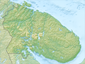
Located 60 km west of the Kola Bay . The Titovka River flows into the lip, as well as several streams [1] . The Lysiy cape cuts into the lip in the middle part [1] . In the waters of the lip are located the small islands Ovechiy (64.2 m) and Titovskiy (3.8 m) [1] . On the island of Titovsky arranged pier [1] . Anchorage of vessels is possible between the islands and the mainland [1] .
The western and eastern shores of the bay consist mainly of large (up to 342 m [1] ) stone [2] steep mountains [1] , the southern coast, near the mouth of the Titovka river, sandy and low-lying [1] . The depth of the bay gradually decreases to the top of the lip, which dries to a low tide of 2 km in length [2] .
At the beginning of the 20th century, Motovsky Pogost , in which there was a church [2] , was located on one of the Titovskaya Bay, the Saami fished in the gulf, mainly salmon [2] .
On the southern shore of the bay there is the uninhabited and abolished in 2007 [3] village of Novaya Titovka . Administratively the bay is included in the Kola district of the Murmansk region of Russia .
Notes
- ↑ 1 2 3 4 5 6 7 8 9 10 11 12 13 Sheet of the card R-36-89.90 Zaozerny . Scale: 1: 100,000. 1981 Edition.
- ↑ 1 2 3 4 Titovskaya Bay // Brockhaus and Efron Encyclopedic Dictionary : 86 tons (82 tons and 4 extras). - SPb. , 1890-1907.
- The law of the Murmansk region “On the abolition of certain settlements of the Murmansk region”