Zaklyuka - a stream in Russia, flows in the Volkhovsky district of the Leningrad region . Right tributary of the river Helena .
| Zaklyuka | |
|---|---|
| Characteristic | |
| Length | 11 km |
| Watercourse | |
| Source | Swamp Kazaryevsky Moss |
| • Coordinates | |
| Mouth | Helena |
| • Location | 0.5 km on the right bank with. Old Ladoga |
| • Coordinates | |
| Location | |
| Water system | Elena → Volkhov → Lake Ladoga → Neva → Gulf of Finland → Baltic Sea |
| A country |
|
| Region | Leningrad region |
| Area | Volkhov district |
| HWR Code | |

Content
Geography
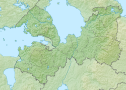
Zaklyuka originates from a network of drainage canals on the Kazaryevsky Mokh bog, in the upper reaches it flows through the northwestern part of the city of Volkhov , below on the creek are the villages: Kikino, Vikovshchina, Knyshchina. In the village of Staraya Ladoga , on the right, flows into the Elena River, which below this place is called Ladozhka. The length of the stream is 11 km.
Water Registry Data
According to the state water register of Russia, it belongs to the Baltic Basin District , the water area of the river is Volkhov, the river sub-basin of the river is Volkhov. It belongs to the river basin of the Neva River (including the basins of the rivers Onega and Ladoga) [2] .
According to the geographic information system of water management zoning of the territory of the Russian Federation, prepared by the Federal Agency for Water Resources [2] :
- The code of the water body in the state water registry is 01040200612202000019695
- Hydrological code (GI) - 102001969
- Pool code - 04/01/02/006
- GI Volume Number - 2
- Issue on GI - 0
Notes
- ↑ Surface water resources of the USSR: Hydrological knowledge. T. 2. Karelia and the North-West / ed. E. N. Tarakanova. - L .: Gidrometeoizdat, 1965. - 700 p.
- ↑ 1 2 State Water Register: ru. Zaklyuka . state water registry . Archived April 9, 2013.