"Tuzlovsky estuaries" ( Ukrainian "Tuzlovsky limany" ) is a national natural park located on the territory of the Tatarbunarsky district ( Odessa region , Ukraine ). Created January 1, 2010 . Area - 27 865 ha.
| Tuzlovsky estuaries | |
|---|---|
| Ukrainian Tuzlovsky limani | |
 Shores of Lake Salty | |
| IUCN Category II ( National Park ) | |
| basic information | |
| Square | 27 865 ha |
| Established | January 1, 2010 |
| Location | |
| A country |
|
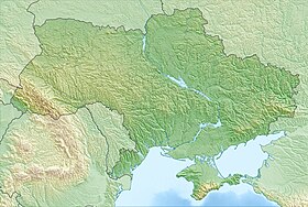
| Region | Odessa region |
| Nearest town | Tatarbunary |

History
Planning of this territory, as part of the nature reserve fund of Ukraine, began in 1993, when the territory of the estuaries Shagany, Alibey and Burnas in the Tatarbunarsky district of Odessa region, according to scientific observations of Igor Shchegolov and Ivan Rusev , experts of the Fund for the Protection and Revival of Wildlife named after . prof. I. I. Puzanova - was included in the "List of territories reserved for subsequent conservation" by the decision of the regional council of 01.10.1993 No. 496 - XXI "On measures for the conservation and development of the natural reserve fund of the region."
Since lakes are of great importance as a nesting, wintering and stopping place during the seasonal migrations of a large number of wetland birds, since 1995, by the Decree of the Cabinet of Ministers of Ukraine of November 11, 1995 No. 935, the Shagany-Alibey-Burnas estuary system was included in the list wetlands of international importance in accordance with the criteria of the Ramsar Convention.
The environmental status of the territory is also confirmed by a number of other regulatory legal acts. So, in the National Program for the Protection and Reproduction of the Environment of the Azov and Black Seas, approved by the Law of Ukraine of March 22, 2001 No. 2333-III, paragraph 3.2. “Preservation of the habitat of biological species” defines the need for “ensuring a further increase in the area and territories of the nature reserve fund, as well as their streamlining”.
In 1996, experts of the Fund for the Protection and Revival of Wildlife. prof. I. I. Puzanova "Natural Heritage" I. T. Rusєvim and I.I. Shchegolev prepared and submitted for approval to the State Ecology Administration in the Odessa region a scientific justification for the creation of the Tuzlovsky Estuary Regional Landscape Park.
In 2007, in Article 4 of the Law of Ukraine dated 22.02.2007 No. 685-U “On Ratification of the Protocol on the Conservation of Biodiversity and Landscapes of the Black Sea to the Convention for the Protection of the Black Sea from Pollution”, the necessity of creating nature reserves in the Black Sea coastal zone : “Each Contracting Party shall take all necessary measures to protect, preserve, improve and manage in a sustainable and environmentally friendly manner areas of special biological or landscape value, primarily by creating protected areas ry ... ".
The Decree of the President of Ukraine “On the expansion of the network and territories of national natural parks and other nature reserves” dated December 1, 2008 No. 1129/2008 states: “In order to ensure the maintenance of ecological balance, preservation, recreation and effective use of natural complexes and objects having a special environmental, health, historical, cultural, scientific, educational and aesthetic value, accelerate the formation of the national ecological network, I decide: To support the initiative of the regional governments administrations regarding the creation of the national natural park "Tuzlovsky estuaries", Odessa region.
But the issue of preserving the wetlands of the Tuzlovsky estuaries for more than 10 years was restrained due to the lack of adequate funding for a detailed scientific study of the territory, the preparation of the appropriate justification and the preparation of cartographic materials. The solution to this issue became possible after the inclusion in the program of the formation of the national ecological network of the Odessa region, adopted by the regional council in November 2005, of measures to create the "Regional Landscape Park" Tuzlovsky Estuary "."
In the same 2005, the Tatarbunar district state administration appealed to the regional state administration with a request to create a regional landscape park in the region, on the basis of which the corresponding work was begun. So, from the regional budget in 2006, the Tatarbunar district state administration allocated 170 thousand UAH. for the development of a project to form the territory of the future landscape park, and the Department of Education and Science of the Regional State Administration - 30.0 thousand UAH. to organize the preparation of a scientific justification. A scientific justification has been prepared and all cartographic material on the formation of the territory of the RLP has been sent for consideration and approval to the district state administration, village councils and the district council, since the procedure for creating reserved objects provides for the preliminary consent of the landowners and land users of the territory, with the subsequent adoption of the relevant decision of the regional council.
In 2009, the Southern Scientific Center of the National Academy of Sciences and the Ministry of Education and Science of Ukraine carried out research work on the project for the creation of the NPP "Tuzlovsky estuaries".
In order to preserve, reproduce and rationally use the natural complexes of the Black Sea estuaries classified as wetlands of international importance (Ramsar Convention), which are of high conservation, aesthetic, scientific, recreational and health value, by Decree of the President of Ukraine dated January 1, 2010 No. 1 / 2010 the national natural park “Tuzlovsky estuaries” was created. According to Art. 21 of the Law of Ukraine "On the Nature Reserve Fund of Ukraine" in the territory of national natural parks, a differentiated regime for its protection, reproduction and use is established in accordance with functional zoning. The creation of a national natural park will preserve the uniqueness of the place and provide constant scientific observation, timely response to negative trends degradation and the possibility of their prevention. But the creation of the park does not solve the whole complex of problems, since much also depends on the zoning of the park.
The decree was adopted on the basis of an appropriate creation project, the preparation of which by joint efforts was provided by the State Department of Environmental Protection in the Odessa Region, the regional state administration, scientists of the Odessa National Institute named after I. I. Mechnikov and the Southern Scientific Center of the National Academy of Sciences of Ukraine and the Ministry of Education of Ukraine, the state-owned enterprise Odessa Institute of Land Management, with the assistance of the Tatarbunar regional public environmental organization Vozrozhdenie.
Thus, a group of Tuzlovsky estuaries acquired a high security status. On the recommendation of scientists, in the near future scientific materials will be prepared to justify the expansion of the territories and water areas of the Tuzlovsky Estuary National Natural Park, with the inclusion of the endangered villages of the Tatarbunarsky district, as well as the Sasyk estuary, in the borders of the park.
Description
The park includes the water area of the group of lakes Tuzlovsky estuaries , the Black Sea spit that separates the Tuzlovsky estuaries from the Black Sea, estuary wetland sections of rivers flowing into the lakes (Lake Solyonoye - Alkaliya river, Hadzhider - Hadzhider , and others), forest tract "Lebedivka".
The total area of the national natural park is 27,865 hectares of state property:
- 2 022 hectares - reserve lands that are provided to the park for permanent use
- 316,831 - sand spits of the Black Sea
- 1 705,169 - lands of the water fund: water areas of lakes of the Tuzlovsky estuary group
- 25 843 ha - lands that are included in the park without withdrawal
- 3,233.18 - reserve lands
- 21,186.03 - lands of the water fund: water areas of lakes of the Tuzlovsky estuary group
- 541 - lands that are in permanent use of the state enterprise "Saratsk Forestry"
- 882.79 - the adjacent waters of the Black Sea 200 m wide.
- In the interfluve of the Danube and the Dniester, along the sea coast, there is a chain of shallow estuaries that enter the territory of the Tuzlovsky Estuary National Natural Park. This chain begins with the Dzhantsheysky estuary, along which Maly Sasyk goes to the east, the Tuzlovsky estuaries: the largest in area - Shagany, Alibey, Burnas - and the smaller estuaries - Magalevske, Martaza, Buduri, Karachaous, Hadzhider, Kurudiol, Solyonoye. The length of the embankment that separates the estuaries from the sea is 36 km; its width in different areas varies from 50 to 350-400 meters. The formation of estuaries is historically associated with fluctuations in the water level of the Black Sea, as well as the processes of raising and lowering the coastal strip of land. As a result of the interaction of geological, climatic, hydrological and chemical processes, water bodies changed their shape and size, the shape of coastal and underwater slopes, the composition and thickness of bottom sediments, the amplitude of fluctuations in the level and ionic composition of the water, the position and size of the crawl, the number of holes in it (“breakthrough” »), On which estuaries were filled with sea water or dumped their waters into the sea. The estuaries are shallow, their depths range from 0.6 to 3 meters. The water areas of the estuaries Dzhantshaisky and Maly Sasyk have small areas (7.3 and 2.7 km2, respectively), their depths do not exceed 0.6–1.2 m. An important feature of the configuration of these reservoirs is their extension from west to east and excess width over length . For the estuaries of the Tuzlovsky group, the bowl is also twisted almost perpendicular to the river valleys. The width of the Shagana estuary exceeds the length by 1.8 times. In the estuaries Alibey, Karachaus and Burnas, into which the rivers Hadzhider, Tsarichanka and Alkali flow, respectively, the length is 1.2–1.5 times the width. At the confluence of rivers, the coastline forms the contours of shallow bays and “secondary” estuaries: Dzhantsheysky with Stavok Bay, Shagany with Martaza and Buduri Bays, Alibey with Karachaus and Hadzhider estuaries, Burnas with Kurudiol and Solenoe estuaries. The geological structure of the estuary deposits of the Tuzlov estuaries is significantly different from other estuaries of the Black Sea. The banks of the estuaries rise above the current water level by 0.5-18 meters. Among the modern geological processes that affect the formation of coasts, the most common are abrasion, landslides, biogeomorphological and accumulative processes.
- All estuaries are characterized by the presence of medicinal mud (peloids), which have long been used by local residents and recreants. The balneological resources of estuaries are suitable for therapeutic use in diseases of the organs of the musculoskeletal system, central and peripheral nervous system, cardiovascular system, digestive organs, gynecological diseases, and skin diseases.
Nature
Hydrology
The level regime of estuaries and the chemical composition of their waters is ensured by the interaction of many factors, the main ones are: annual runoff, precipitation, evaporation, sea water inflow, underground runoff, depth, width, length of water bodies. The influence of certain factors in the estuaries of various types is not the same, which determines the characteristics of the chemical composition of the water of each of them.
As a result of postglacial transgression, estuaries and sea bays arose in river valleys. Almost all estuaries survived the open estuary stage, which has changed, in most cases, by the estuary. From the beginning of the formation of estuaries and during their development, the chemical composition and mineralization of estuary waters has repeatedly yielded to changes, clearly responding to changes in geological, geomorphological and climatic conditions.
The course of the water level in the estuaries is determined by the sea level regime, the intensity of water exchange with the sea, the regime of small rivers that flow into some water bodies and the evaporation process. The main regime-forming factor can be considered the flow of sea water through natural or artificial breakthroughs. The hydrodynamic, temperature and hydrochemical regimes of estuaries depend on the time and frequency of the work of these abysses.
The hydrochemical regime of the estuaries of the Tuzlov group has not changed significantly, with the exception of the western part of the Shagany estuary, where the slightly saline waters of the Sasyk reservoir fall. The main part of the waters of the Tuzlovsky estuaries has a salinity of 20-30 g / l and belongs to the chloride class, the sodium group. The formation of the estuaries of the Tuzlov group is associated with sea level fluctuations, as well as with the processes of raising and lowering the coastal strip of land. Due to the shortage of sediments and the strong wave impact, the seashore of the embankment recedes at a speed of 0.5–3.0 m / year, and the estuary coastline grows at about the same speeds, that is, the embankment shifts towards the land for a long time. For the Shagany and Alibey estuaries, the displacement rate is 1.5–2 m / year, for Burnas – 3 m / year.
The continental coast is steep, 2-18 meters high. The bottom of water bodies consists mainly of silty soils. Under the influence of wind waves and due to fluctuations in the water level, there is a constant formation, movement and erosion of sand cores and islands. The main factors determining the current conditions for the formation of estuaries are: water exchange with the sea through natural and artificial breakthroughs in spring and autumn; precipitation, evaporation from the slopes, runoff during the separation of estuaries from the sea.
The plowing of the coastal strip in many parts of the estuaries almost to the edge of the water, intensive abrasion of the root coast, overgrazing in the coastal stripes led to a significant reduction in the indigenous types of vegetation: solonchak meadows and fescue – feather grass steppes. Sandy embankment and islands are underdeveloped; they experience average anthropogenic pressures from fishing, hunting, recreational activities, and grazing. The following groups of mineral waters are distinguished on the territory of the district: hydrogen sulfide, iodine – bromine, mineral and therapeutic (the effect of which is determined by the different composition of salts).
Climate
The climate of the southern regions of Odessa region is characterized as temperate continental, with long hot summers, and mild, less often cold and little snowy winters.
The average annual values of solar total radiation vary between 116-120 kcal / sq. cm, and the radiation balance is from 53 to 54 kcal / sq. see About 75% of the solar radiation reaches the earth in a very short time. The amount of photosynthetic active radiation entering the soil surface in the steppe zone during the growing season is 50 kcal / sq. cm.
The average annual air temperatures are positive and correspond to an average of +8.1 and +11.8 degrees. C. The coldest period is January-February, in some years the average air temperature reached -7 and -10.3 degrees. C., respectively.
With the invasion of arctic air masses, air temperature drops sharply. The absolute minimum was recorded in January 1985. and amounted to -26.2 degrees. C.
Air masses coming from the sea in winter cause sharp increases in air temperature, which causes the occurrence of an intense thaw lasting up to 5-8 days. On average, during the winter period there are about 20-30 days with a thaw. Air temperature during thaws rises to +13 - +15 degrees. C. Frequent repeatability and long duration of the thaw make it possible to feed groundwater in winter.
Stable positive air temperatures are usually set in the first ten days of March. The average monthly temperature varies from +0.4 to +24 degrees. C., with mean annual values of +3.5 degrees. C. The exception was 1985 and 1987, when the average long-term air temperature was -1.9 and -2.8 degrees. C. respectively.
The summer period is distinguished by high temperatures. The hottest month is July, when the average monthly temperature reaches +24.7 g. C. at an average long-term +22.3 degrees. C. The maximum temperature was recorded in the second decade of 1981 and amounted to +43.1 degrees. C.
Autumn fall in air temperature begins in the month of November with the final transition through negative values in the second decade of December. Minimum temperatures reach minus 15 - minus 17 degrees. C. at mean annual temperatures of -0.1 degrees. C. - -3.9 degrees. C. Although in some years the average monthly air temperature was positive and reached +3.8 degrees. C.
The average annual precipitation varied from 200 to 711.6 mm. Most of them fell in the warm season from May to October - from 53 to 87%. However, in 1981, 1984 and 1988, during the cold season, precipitation was significant and amounted to 55.58 and 52% of the rainfall of the year, respectively. The maximum amount of precipitation falls in January and February, the average annual precipitation for the months is 23.2 and 21.7 mm with a range of variation from 1 to 56.2 mm in January and 1.2-49.1 mm in February.
In the warm period, precipitation, as a rule, occurs locally and is stormy. In winter, typical prolonged precipitation of low intensity.
For most of the year, winds of the north and north-east directions prevail, their repeatability for the year from 36 to 47%. Due to this, the windward slopes of water spills and river valleys receive 15-20% more precipitation than the leeward ones. Apparently, this is one of the main reasons for the more intense manifestation of landslide and erosion processes on the slopes of northern and western expositions.
Landscapes
The landscapes of the estuaries of the Tuzlov group are unique in origin, development and biodiversity. But due to intensive economic activity, most of the landscapes are transformed. Distribution of anthropogenically disturbed areas leads to the degradation of natural groups and prevents their restoration and normal functioning. Under such conditions, the question arises of preserving and protecting estuary natural complexes. The most common types of economic impact that cause negative consequences include: development of the coast of estuaries; excessive plowing of the territory, including and sloping lands; the use of valley-girder and terraced areas as pastures; development of building materials; clear-cutting and insufficient restoration of shelterbelts; excessive recreational pressure on the coast. All changes in the landscape structure caused by this influence lead to the formation of the following classes of anthropogenic landscapes: agricultural, water, forest, recreational and road.
Ichthyofauna
Of the industrial species of fish in the estuaries, only a few species of gobies constantly lived (the most numerous zelenchuk sandpiper, round timber) and floss glossa. In the warm period, when there is a connection with the sea, the Black Sea mullet (mainly singyl - up to 80%, as well as pointed and lobed) and atherin for feeding and spawning enter here for feeding in large numbers.
Today, 58 species of fish belonging to 21 families are found in the reservoirs of the Tuzlovsky Natural Park, which include the Tuzlovsky estuaries and the coastal waters of the sea. The greatest diversity is the composition of the ichthyofauna of the coastal zone of the sea. There are 47 species of fish. 28 species are found in freshwater estuaries (Dzhantshaisky and Maly Sasyk), and 26 species are found in other (salty) Tuzlovsky estuaries. Within the water bodies of the national natural park, the most common marine and saltwater species. Freshwater species are represented mainly by the cyprinid family. In general, the most common representatives of the Karpov, Kefalev, Bychkov family.
More than half of the species that are found in the waters of the Tuzlovsky Natural Park are protected species (28 species). Of the fish that are listed in the Red Book of Ukraine, the most interesting are the representatives of the Sturgeon family. Along the coast of the spit that separates the Tuzlovsky estuaries, Dzhantshaysky estuary and Maly Sasyk from the sea, there are sturgeon migration routes, in addition, the indicated water area is used by young people of the Danube population of beluga, stellate sturgeon and Russian sturgeon for pre-winter feeding.
By the nature of spawning, most fish species found in the waters of the national natural park are phyto- and lithophiles.
Amphibians and Reptiles
The herpetofauna of the park is small in number, which is probably associated with a significant transformation of the coast of the estuaries of the park, as well as with a small biotope diversity of the territory.
In the park, 2 species of amphibians and 5 species of reptiles were identified; abundance counts were carried out for some species. Marked: lake frog (Pelophylax ridibundus), green toad (Bufo viridis), nimble lizard (Lacerta agilis), multi-colored lizard (Eremias arguta), common snake (Natrix natrix), water snake (Natrix tessellata) and yellow-bellied hornbill , 2 more species of reptiles are present in literary sources and are generally characteristic of the region.
Amphibians living in the park are important natural regulators of the number of blood-sucking insects (mosquitoes, midges) in fresh water, which is especially important, given the presence of resort areas (Katranka, Rassєyka, Lebedevka). The number of frogs per l. Dzhantsheysky and l. Small Sasyk, as was noted in previous years, fluctuates significantly depending on the amount of salt water entering the l. Shagans, and with l Presn. Sasyk. A significant increase in the number of blood-sucking insects was noted precisely in the years of the decline in the number of amphibians. But, of course, amphibians are no less important as an integral part of trophic chains in nature, because 90% of the diet of snakes, many near-water birds are precisely frogs and their tadpoles. The role of reptiles as regulators of the numbers of representatives of other groups is also significant.
Birds
The Shagany – Alibey – Burnas estuary group is a wetland of international importance, mainly as a habitat for waterfowl. One of the largest transport migration corridors of birds, through which they fly to Europe, Asia and Africa, passes through the territory of the NPP Tuzlovsky Estuaries. On the territory of the Park, 256 species of birds were recorded (which makes up about 60% of the total species composition of birds in Ukraine), of which 54 are listed in the Red Book of Ukraine and other conservation lists. The territory of the Tuzlovsky estuaries is important for birds during nesting. More than 60 species have nested in the Park (which is 22% of the species composition of birds nesting in Ukraine). Based on the foregoing, NPP "Tuzlovsky estuaries" plays an important role for the existence of birds and is an ornithological object of both national and international importance.
The greatest importance for the avifauna of the Park both during migrations and during nesting is sandy-muddy islands and spits, shallow areas, salt marshes, deltas of small rivers flowing into estuaries and steep banks of estuaries.
The basis of nesting orniocomplexes is composed of Charadriiformes (gulls, terns and waders), 8 species of which are listed in the Red Book of Ukraine. The following species were recorded on nesting: avdotka, sandpiper – magpie, small snake, sea snake, lapwing, black-winged stilt, shiloklyuvka, herbalist, meadow tirushka, black-headed grouse, black-headed gull, sea dove, tailed beak tern, red-tern tern, river tern, tern. The most common at nesting are Speckled tern, River tern and Laughter, the number of which in some years can reach more than 10 thousand pairs.
Plants
The park is located in the steppe zone. That is, zonal vegetation is steppe. In addition to it, the park has forest vegetation, mainly of artificial origin (forest stands created by employees of the Tuzlovsky forestry of the state enterprise "Saratsk Forestry"). Also, there is aquatic, coastal-aquatic (marsh), meadow, solonchak and coastal psamophytic vegetation. There are minor fragments of shrub groups.
Flora of the Tuzlovsky Estuary National Natural Park, which includes 507 species of higher vascular plants from 289 genera and 78 families. Now the inventory of flora continues.
Herb plants account for more than 80%, woody species 15.25%, semi-woody plants - only 2.5%. Among herbs, perennial plants predominate, this indicates that the naturalness of the flora is preserved. But also significant is the proportion of annual herbs. This indicates anthropogenic possible violations of the ecotope of the park.
All woody plants on the territory of the NPP "Tuzlovsky estuaries" are of artificial origin. The exceptions are the bush Tamarix ramosissima and the bush Ephedra distachya, which belong to the natural flora.
Among the various ways of spreading fruits and seeds, anemochornia prevails (by wind - 45.0%). Zoochoria is also very important (animals - 40.25%). A significant proportion of species is distributed by humans (17.75%).
In the territory of the national natural park, the gene pool of a significant number of useful plants is preserved. The largest is the proportion of medicinal plants. Also, many fodder and honey species. In fourth place are weeds.
| Alibey | Burnas | Shagans |
Gallery
Links
- The text of the law (in Ukrainian)
- official site of the national natural park "Tuzlovsky estuaries" http://tuzlim.org. ua
- Website "Nature of Ukraine" (in Ukrainian)
- Pearls of the Black Sea (Ukrainian)
- National Natural Park "Tuzlovsky Estuaries": value and problems // Steppe Bulletin. No. 46 spring 2016.
- Contrary to the court ruling: a storm connected the Tuzlov estuaries with the sea (October 13, 2016)
- Battle of the Breakthrough | Reflection.
- Doctor of Biological Sciences, Professor Ivan Rusev: The paradox is that the national parks of the Odessa region are headed by poachers ... (July 14, 2015)
- Ivan Rusev leaves the post of director of NPP Tuzlovsky estuaries | Bessarabiainform. 12/08/2016.