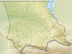
Aspara [1] or Ashmar [2] ( kaz. Aspara , Kyrgyz. Ashmar ) is a river in the Merken district of the Zhambyl region of Kazakhstan and the Panfilovsky district of the Chui region of Kyrgyzstan . Included in the basin of the Chu (Shu) river.
| Aspara, Ashmar | |
|---|---|
| kaz Aspara , Kirgh. Ashmar | |
| Characteristic | |
| Length | 108 km |
| Pool | 1210 km² |
| Water flow | 3.31 m³ / s |
| Watercourse | |
| Source | |
| • Location | Kyrgyz ridge |
| • Height | 3320 m |
| • Coordinates | |
| Mouth | Dried apricots |
| • Location | near the village of Tasotkel |
| • Height | about 530 m |
| • Coordinates | |
| Location | |
| Water system | Kuragaty → Chu → Akzhaykyn |
| Country |
|
| Regions | Zhambyl region , Chui region |
| Areas | Merkensky district , Panfilovsky district |

Description
Aspara is 108 km long and has a catchment area of 1210 km². The average annual flow rate is 3.31 m³ / s; maximum - 9.66 m³ / s, minimum 1.02 m³ / s. The river is full of water from May to September [2] .
Aspara is formed on the northern slope of the Kyrgyz Range (Kyrgyz Ala-Too) , in the area of the Kyrgyz-Kazakh state border. On the territory of Kazakhstan, a little to the west of the Ashpara-Ashuu pass [room 1] , the Asparabashi river (“the upper reaches of the Aspara”) originates, composed of two sources (one of them flows from a high-mountain lake) [3] . In the upper reaches of Ashmar, in addition, it collects the waters of the small rivers Ashuu-Tur , Esenaman ( Aman-Esen ), Baktybai , Tuyyktor ( Tuyok-Tur ), Kek-ter flowing from the same glaciers [2] [3] . In total, 34 small glaciers are located in the river basin, the total area of which is 17.8 km² [2] .
The general direction of the Aspara current is from south to north, in some areas with a slight bias to the west (in the area of the source) [3] or east (somewhat further, above the village of Granitogorsk ) [4] . From the confluence of Asparabashi with Ashuu-Thor along the river, the state border of Kyrgyzstan and Kazakhstan was drawn for a considerable extent [3] [4] [5] . In the area of the settlement Novovoskresenovka a little departs from the border and flows through Kazakhstan [5] . In the lower reaches, there are wetlands, meadows, and reed beds on the banks; in places the channel dries up [6] .
According to the topographic maps of the General Staff, Aspara flows into the Igmen River above the Tatta Reservoir [6] , and, in turn, Igmen flows into the Kuragaty River. The encyclopedia “Chui oblast” reports that Aspara is a tributary of the Kuragat River (Kuragaty) and includes Mahan, which flows into the Tatta Reservoir, as one of the tributaries of the Aspara River, thus attributing a section to it even after its confluence with the Igumen [2] [6] .
River water is used for irrigation [2] .
On the banks of the Aspara there are settlements Granitogorsk , Cholok-Aryk [4] , Chaldovar (Chaldybar) , Novovoskresenovka , Aral-Kichilak , Kenes [5] , Rovny [2] [ where? ] .
Tributaries of Aspara
Some tributaries flowing into the river from the confluence of Asparabashi and Ashuu-tera: Esenaman ( Aman-Esen , left), Kumbel Vost. (left), Baktybai (right), Yundy-Toby (right), Aksay (left), Chetindi (right), Tuyyktor ( Tuyuk-Tor , left), Archaly ( Arshaly , right), Chetenda (left), Kyzylauyz Vost. (left), Belen-Teke (right), Chaar (left) [3] , Budurtash (right), Kuntiybes (right), Botolu (left), Kashkansu (left), Zholdisay (left) [4] . The encyclopedia “Chuy oblast” indicates the Mahan River ( Maham ), which flows into the Tatta Reservoir, below the confluence with the Highermen (and, therefore, can be interpreted as a tributary of the latter) as a major tributary of Ashmara [6] .
Notes
- Comments
- ↑ Here the border, going east-west, turns north
- Sources
- ↑ Map sheet K-43 . Scale: 1: 1,000,000.
- ↑ 1 2 3 4 5 6 7 Chui oblast. Encyclopedia. - Bishkek, 1994.
- ↑ 1 2 3 4 5 Map sheet K-43-51 Taldy-Bulak . Scale: 1: 100,000. State of the area in 1984. 1987 edition
- ↑ 1 2 3 4 Map sheet K-43-39 Merke . Scale: 1: 100,000. State of the area in 1983. 1988 edition
- ↑ 1 2 3 Map sheet K-43-40 of Kara-Balta . Scale: 1: 100,000. State of the area in 1985. 1990 edition
- ↑ 1 2 3 4 Map sheet K-43-27 Tatti . Scale: 1: 100,000. State of the area in 1983. 1987 edition