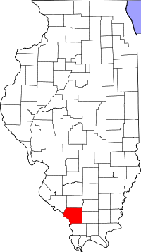
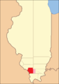
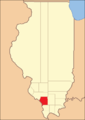
Jackson County is a county in the state of Illinois , USA . According to the 2010 census, the district’s population was 60,218 people, compared with the 2000 census, it increased by 1.0% [1] . Jackson County County Center - Murphysboro City.
| district | |
| Jackson County | |
|---|---|
| English Jackson county | |
| A country | |
| Included in | state of illinois |
| Adm. Centre | Murphysboro |
| History and Geography | |
| Date of formation | 1816 |
| Square | 1560 km² (1.04% ) |
| Timezone | UTC-6 , summer UTC-5 |
| The largest city | Carbondale |
| Population | |
| Population | ▲ 60,218 people ( 2010 ) (0.46%) |
| Density | 38.6 people / km² |
| Official site | |
 | |
History
Jackson County is formed from Randolph County in 1816 . Named after Andrew Jackson , under whose command the Americans defeated the British troops in the battle for New Orleans , in 1829 he was elected to the post of President of the United States .
On March 18, 1925, the county was badly damaged by the most destructive tornado in US history, the villages of Goram and De Soto, as well as the city of Murphysboro, turned into ruins [2] .
The current building of the district court, located in Murphysboro , was built in 1927-1928 on the site of the old wooden structure. The original building was located along the Big Maddy River in Brownsville (now a ghost town [3] ) and was destroyed by fire. Then, on February 27, 1843, a commission was created by the Illinois General Assembly , which was to select the new center for Jackson County [4] .
The district, from its founding until 1818, included temporarily annexed unorganized territory
The territory of the district from 1818 to 1827
The territory of the district from 1827 to the present day


Geography
The total area of the district is 1560.2 km² (602.38 miles²), of which 1512.8 km² (584.08 miles²) or 96.96% of land and 47.4 km² (18.3 miles²) or 3.04% of water surface [5] .
Not far from where the Illinois-127 highway bridge is now located, the first Illinois coal mine was discovered on the south bank of the Big Maddy River [6] .
Shawnee National Forest is partly located in the county.
Climate
The district is located in a zone of humid subtropical climate . Temperature varies on average from a minimum of −6 ° C in January to a maximum of 31 ° C in July. A record low temperature was recorded in January 1977 and amounted to −32 ° C, and a record high temperature was recorded in August 1930 and amounted to 45 ° C. The average monthly rainfall is from 74 mm in January to 121 mm in May [7] .
Neighboring Counties
Jackson County is bordered by counties:
- Perry - North
- Franklin - Northeast
- Williamson - East
- Union - in the southeast
- Perry , Missouri - West
- Randolph - Northwest
Major Highways
| Motorway | Length | Starting point | Final destination | Year of foundation |
|---|---|---|---|---|
| Highway US-51 | 2070 km | Laplace , Louisiana | Hurley , Wisconsin | 1926 |
| Highway Illinois-3 | 301.66 km | Cairo | Grafton | 1918 |
| Highway Illinois-4 | 274.3 km | Vergenes | Springfield | 1918 |
| Highway Illinois-13 | 243.88 km | Canterville | Old Shawnitown | 1918 |
| Highway Illinois-127 | 269.61 km | Unity | Raymond | 1924 |
| Highway Illinois-149 | 73.9 km | Goram | Thompsonville | 1926 |
| Highway Illinois-151 | 12.62 km | Jacob | Ava | 1940 |
Settlements
| Locality | Status | Year of foundation | Square | Population ( 2010 ) |
|---|---|---|---|---|
| Vergenes | village | 0.91 km² | 7970 people [eight] | |
| Goram | village | 3.2 km² | 236 people [9] | |
| Grand tower | city | 3.2 km² | 605 people [ten] | |
| Dowell | village | 1.0 km² | 408 people [eleven] | |
| De soto | village | 1854 | 2.4 km² | 1590 people [12] |
| Carbondale | city | 1852 | 45.4 km² | 25 902 people [13] |
| Campbell hill | village | 1.1 km² | 336 people [14] | |
| Makanda | village | 13.8 km² | 561 people [15] | |
| Murphysboro | city, district center | 1843 | 13.6 km² | 7970 people [sixteen] |
| Ava | city | 2.8 km² | 654 people [17] | |
| Elkville | village | 2.0 km² | 928 people [18] |
Demographics
| Census year | Population | Growth |
|---|---|---|
| 1900 | 33871 | - |
| 1910 | 35143 | ▲ 3.8% |
| 1920 | 37091 | ▲ 5.5% |
| 1930 | 35680 | ▼ 3.8% |
| 1940 | 37920 | ▲ 6.3% |
| 1950 | 38124 | ▲ 0.5% |
| 1960 | 42151 | ▲ 10.6% |
| 1970 | 55008 | ▲ 30.5% |
| 1980 | 61522 | ▲ 11.8% |
| 1990 | 61067 | ▼ 0.7% |
| 2000 | 59612 | ▼ 2.4% |
| 2010 | 60218 | ▲ 1.0% |
According to the 2000 census [1] , the population in the district was 59,612 people, there were 24,215 households and 12,664 families. The average population density was 38.2 people / km² [19] .
Racial distribution of the population:
- white - 80.79%
- German descent - 22.0%
- Irish descent - 10.0%
- English origin - 8.6%
- African Americans - 13.02%
- Native Americans - 0.31%
- Asians - 3.03%
- Latins - 2.42%, etc.
Of the 24,215 households, 24.4% had children under the age of 18 years living with their parents, 39.3% had married couples living together, 9.7% had single mothers, and 47.7% did not. had families. 34.9% of all households consisted of individuals and 9.3% of them were single people aged 65 and over. The average household size is 2.21 and the average family size is 2.89.
Population by age:
- under 18 years old - 19.3%
- from 18 to 24 years old - 26.0%
- from 25 to 44 years old - 25.9%
- from 45 to 64 years old - 17.9%
- from 65 years old - 11.0%
The average age was 28 years. For every 100 females there are 104.3 males. For every 100 females age 18 and over, there are 102.9 males.
The average household income is $ 24,946, the family income is $ 40,950. The average income for men is $ 31,910, for women $ 22,396. Per capita income in the district is $ 15,755. About 14.7% of families and 25.2% of the population were lower poverty lines, of which 23.0% are persons under the age of 18 and 10.5% are 65 years of age or older.
See also
- US Administrative Division
Notes
- ↑ 1 2 Jackson County Census 2010 Data: Population (inaccessible link) . Cubit Planning. Date of treatment January 18, 2013. Archived January 29, 2013.
- ↑ Thomas Grazulis. Significant Tornadoes 1680-1991: A Chronology and Analysis of Events. - Atlantic Books, 1993 .-- 1326 p. - ISBN 1-879362-03-1 .
- ↑ Glenn Sneed. Ghost Towns of Southern Illinois. - Johnston City, IL: AERP
- ↑ Courthouse ( inaccessible link) . Jackson County. Date of treatment January 18, 2013. Archived January 29, 2013.
- ↑ Census 2010 US Gazetteer Files: Counties . United States Census. Date of treatment January 18, 2013. Archived on September 9, 2012.
- ↑ Stu Fliege. Tales and Trails of Illinois . - University of Illinois Press, 2002 .-- P. 36-39. - 236 p. - ISBN 9780252070853 .
- ↑ Monthly Averages for Murphysboro, IL (inaccessible link) . The Weather Channel, LLC. Date of treatment January 18, 2013. Archived January 29, 2013.
- ↑ Vergennes Village: Census 2010 Data - Population (inaccessible link) . Date of treatment January 18, 2013. Archived January 29, 2013.
- ↑ Gorham Village: Census 2010 Data - Population (inaccessible link) . Date of treatment January 18, 2013. Archived January 29, 2013.
- ↑ Grand Tower City: Census 2010 Data - Population (inaccessible link) . Date of treatment January 18, 2013. Archived January 29, 2013.
- ↑ Dowell Village: Census 2010 Data - Population (inaccessible link) . Date of treatment January 18, 2013. Archived January 29, 2013.
- ↑ De Soto Village: Census 2010 Data - Population (inaccessible link) . Date of treatment January 18, 2013. Archived January 29, 2013.
- ↑ Carbondale City: Census 2010 Data - Population (inaccessible link) . Date of treatment January 18, 2013. Archived January 29, 2013.
- ↑ Campbell Hill Village: Census 2010 Data - Population (inaccessible link) . Date of treatment January 18, 2013. Archived January 29, 2013.
- ↑ Makanda Village: Census 2010 Data - Population (inaccessible link) . Date of treatment January 18, 2013. Archived January 29, 2013.
- ↑ Murphysboro City: Census 2010 Data - Population (inaccessible link) . Date of treatment January 18, 2013. Archived January 29, 2013.
- ↑ Ava City: Census 2010 Data - Population (inaccessible link) . Date of treatment January 18, 2013. Archived January 29, 2013.
- ↑ Elkville Village: Census 2010 Data - Population (inaccessible link) . Date of treatment January 18, 2013. Archived January 29, 2013.
- ↑ American FactFinder (inaccessible link) . United States Census Bureau. Date of treatment January 17, 2013. Archived on September 7, 2012.
Links
- Wikimedia Commons has media related to Jackson County
- Jackson County Official Website (link unavailable) . Archived January 22, 2013.