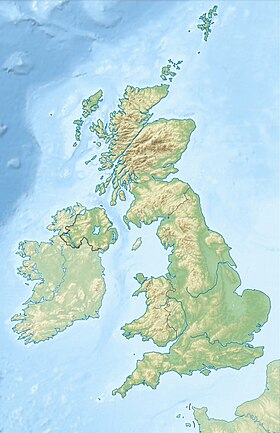
Inchgarvie ( Eng. Inchgarvie ) - a small uninhabited island located in the Gulf of the Firth of Fort off the eastern coast of Scotland , near Edinburgh . Its name comes from Innis Garbhach , which is translated from the Scottish language means "rough island" [1] . Local tradition claims that the island got its name from a young herring, whose name is pronounced “ garvies ”, which was hidden in large flocks around its shores. Although the island is currently uninhabited, Inchgarvi has been inhabited for various periods of history. The first records of this date back to the end of the 15th century. The highest point of the island is located 19 meters above sea level [2] . Its profile and color makes it very similar to a battleship in the distance.
| Inchgarvi | |
|---|---|
| English Inchgarvie | |
 View of the island of Inchgarve | |
| Characteristics | |
| Area | 0.0083 km² |
| Highest point | 19 m |
| Population | 0 pax (2011) |
| Location | |
| Water area | Firth of Fort |
| A country |
|
| Region | Scotland |

Now on the island are the central pillars of the Fort Bridge .
Content
- 1 History
- 2 notes
- 3 Literature
- 4 References
History
In the days when boats were the only way to cross the Firth of Forth , the island was on the main route between North Queensferry in the Fife area and South Queensferry in Lothian . This made him a strategically important target.
On Inchgarve was a castle built by King James IV [3] , presumably for defensive purposes. James ordered the castle to be built on March 20, 1491. [4] In 1497, the island was used as a quarantine zone for the infected Grandgore (syphilis) in Edinburgh [5] . In September 1497, a law was passed according to which people suffering from this disease must retire [6] .
March 8, 1514 Margarita, the widow of William Dundas, committed to complete the construction of the fortress [7] . Two " serpentines " and guns from Colstone (Colstone) were placed on the island after a visit by artillery experts in July 1515 [8] . In 1707, the island, as you know, was leased to Archibald Primrose, 1st Earl of Rosebery. In 1779, however, fortifications on the island were renewed again, in response to a threat posed by John Paul Jones , the American admiral [9] .
Notes
- ↑ Haswell-Smith, 2004 , p. 490.
- ↑ Ordnance Survey
- ↑ Scottish Gazetteer - Overview of Inchgarvie Island . Edinburgh University Geography Dept. Date of treatment April 20, 2007. Archived January 27, 2013.
- ↑ Macleod, Walter, Royal Letters, from the family papers of Dundas of Dundas , Edinburgh (1897), lvii-lix.
- ↑ Pearce, JM S. A note on the origins of syphilis (unknown) // Journal of Neurology, Neurosurgery, and Psychiatry. - 1998. - April ( t. 64 , No. 542 ). - S. 542 . - DOI : 10.1136 / jnnp.64.4.542 . - PMID 9576552 .
- ↑ A Topographical Dictionary of Scotland, pp. 555-84
- ↑ Macleod, Walter, Royal Letters, from the papers of Dundas of Dundas , Edinburgh (1897), lxxiii, citing Acta Dominorum Concillii, 26, f. 43.
- ↑ Accounts of the Lord Treasurer of Scotland , vol. 5 (1903), 20-26.
- ↑ Scotland from the Roadside - Inchgarvie Neopr . ourscotland.co.uk . Date of treatment April 20, 2007. Archived January 27, 2013.
Literature
- Grant, James. Old and New Edinburgh. - Cassell & Co, London, Paris, New York, 1980.
- Haswell-Smith, Hamish. The Scottish Islands. - Edinburgh: Canongate, 2004 .-- ISBN 978-1-84195-454-7 .