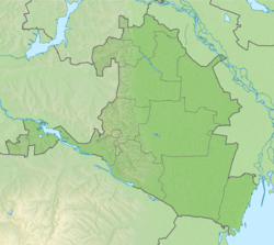
Ovata (in the lower reaches of Buran-Gol [2] ; ( Kalm. Ovata - border) - a drying river in Tselinnoye and Ketchenerovsky districts of Kalmykia . The river flows in a deep gully between the spurs of the Ergeninsky Upland , absorbing the watercourses of adjacent beams. The river is lost on the Caspian lowland. near the village of Shatta .
| Ovata (Buran-Gol) | |
|---|---|
| Calm Ovata (Buran-Һol) | |
| Characteristic | |
| Length | 60 km |
| Swimming pool | 342 km² |
| Watercourse | |
| Source | Ergeni |
| • Location | village of Ovata |
| • Coordinates | |
| Mouth | |
| • Location | near the village of Shatta |
| • Height | 10 m |
| • Coordinates | |
| Location | |
| A country |
|
| Region | Kalmykia |
| Areas | Tselinny district , Ketchenerovsky district |
| HWR code | |
The length of the watercourse is 60 km [3] . The catchment area is 342 [3] km².
Object code: 07040000112108200000378 [3] .
Notes
- ↑ Surface Water Resources of the USSR: Hydrological Understanding. T. 8. The North Caucasus / ed. D. D. Mordukhai-Boltovsky. - L .: Gidrometeoizdat, 1964 .-- 309 p.
- ↑ Topographic map of L-38-IX. Soviet
- ↑ 1 2 3 State Water Register . Ovata river (Buran-Gol beam) . textual.ru . Russian Ministry of Natural Resources (29 March 2009). Reference date 20 December 2018. Archived March 29, 2009.