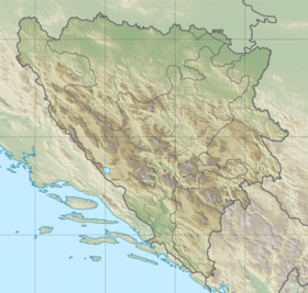
Boria is a mountain in the Republika Srpska . Located in the communities of Kotor Varos and Teslic . Its height is 1,078 meters above sea level. From the south-west, south and east from the mountain flows Velika-Usora , and north-west, north and northeast flows Mala-Usora . Streams and springs flow down from the mountains.
| Borya | |
|---|---|
| Serb. Bore | |
 | |
| Highest point | |
| Absolute height | 1078 [1] m |
| Location | |
| A country |
|
Boria is rich in forest. Especially for their operation in the times of Austria-Hungary , the narrow-gauge railway of Usora — Pribinic, 41 km long, was laid. In the 1960s, it was replaced by the usual road. The forest with Bori is processed in Teslic.
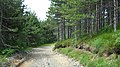
Road in the forest

Forest on the mountain

Plateau Solila

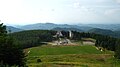
Monument on the mountain

Source "Waterfall"
Hotel "Hauduchka water"

Forest Road


Notes
- ↑ Statistics yearish Republika Srpske, 2017 , p. 27.
Literature
- Statisticks godishњak Republika Srpske. - Baњa Luka: Publications plant for the statistics, 2017. - 525 p.